Area Overview for B14 6QW
Photos of B14 6QW


Area Information
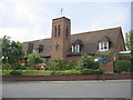
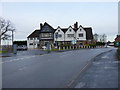
Living in B14 6QW means being part of a small, tightly knit residential cluster in Birmingham’s Brandwood & King’s Heath Ward. With a population of 1,588, the area retains a suburban character shaped by 18th-century development on former heathland. Its proximity to King’s Heath and Selly Oak places it within reach of Birmingham’s cultural and commercial hubs, while its historical roots include early schools, tram services, and the Hare and Hounds pub, a landmark since the 1820s. The area’s compact size fosters a sense of familiarity, with residents likely to know their neighbours. Daily life is balanced between quiet residential streets and accessible transport links, making it suitable for those seeking a blend of tranquillity and connectivity. The absence of major planning constraints—no protected woodlands or AONB coverage—means development is unlikely to disrupt the existing fabric. For buyers, this postcode offers a snapshot of Birmingham’s suburban evolution, where historical architecture coexists with modern infrastructure.
- Area Type
- Postcode
- Area Size
- Not available
- Population
- 1588
- Population Density
- 4347 people/km²
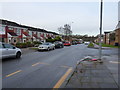
The property market in B14 6QW is dominated by owner-occupied homes, with 83% of properties owned outright. This high home ownership rate suggests a mature market with limited rental activity, which can stabilise property values but may reduce flexibility for buyers seeking short-term tenancies. The prevalence of houses over flats indicates a focus on family-oriented housing, with larger properties likely to be the norm. Given the area’s small size, the housing stock is relatively uniform, which could be advantageous for buyers looking for consistency in property types. However, the limited scale of the postcode means that immediate surroundings—such as adjacent wards—may offer more diversity in options. For those prioritising long-term investment, the stability of the market and the presence of established homes could be appealing.
House Prices in B14 6QW
No properties found in this postcode.
Energy Efficiency in B14 6QW
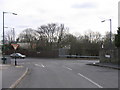
Residents of B14 6QW enjoy a range of amenities within easy reach, from retail to transport hubs. Local shops such as Tesco Kings, Co-op Kings, and Spar provide essential services, while the proximity to rail stations like Bournville and Kings Norton ensures seamless travel to Birmingham’s business and cultural centres. The area’s historical character is complemented by its modern connectivity, with metro stations like Grand Central New Street offering swift access to the city. While the data does not specify parks or leisure facilities, the presence of nearby stations and retail venues suggests a lifestyle that balances convenience with suburban tranquillity. The mix of retail and transport options makes daily life efficient, supporting both professional and personal needs without requiring long commutes.
Amenities
Schools
Residents of B14 6QW have access to two primary schools within proximity: Colmore Junior School, rated ‘good’ by Ofsted, and Colmore Infant and Nursery School, which holds an ‘outstanding’ rating. These institutions cater to early years education and primary schooling, providing a strong foundation for local families. The presence of an outstanding nursery school suggests high standards in early education, which is a significant draw for parents. The combination of two primary schools in the area ensures that children have multiple options for schooling, though the absence of secondary schools means families may need to look further afield for secondary education. This mix of school types reflects a focus on early learning and community-based education, supporting the area’s family-oriented demographic.
| Rank | School | Type | Entry gender | Ages |
|---|
Explore more schools in this area
Go to Schools tabDemographics
The community in B14 6QW is predominantly middle-aged, with a median age of 47 and the majority of residents falling within the 30–64 age range. Home ownership is high at 83%, indicating a stable, long-term population. The area is characterised by houses rather than flats, reflecting a preference for family-friendly living. The predominant ethnic group is White, which aligns with broader trends in the ward. This demographic profile suggests a community with established roots, where local amenities and schools are likely to cater to the needs of families. The absence of specific data on deprivation means it is reasonable to infer that the area’s quality of life is supported by its infrastructure and services, though further local research would be needed to confirm this.
Household Size
Accommodation Type
Tenure
Ethnic Group
Religion
Household Composition
Age
Household Deprivation
NS-SEC
Explore more demographic insights in this area
Go to Demographics tabPlanning
Planning Constraints
- Flood RiskPremium
- Ramsar Wetland SitesPremium
- Area of Outstanding Natural BeautyPremium
- Protected Nature ReservePremium
- Protected WoodlandPremium