Area Overview for B14 6NQ
Photos of B14 6NQ
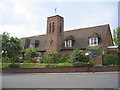
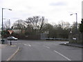
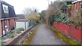
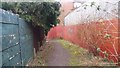
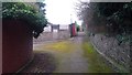
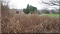
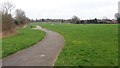
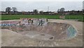
24 photos from this area
Area Information
Key information about the B14 6NQ including its size, population, and administrative classification.
- Area Type
- Postcode
- Area Size
- 3.2 hectares
- Population
- 1871
- Population Density
- 3781 people/km²
House Prices in B14 6NQ
51
Properties
£200,612
Average Sold Price
£43,000
Lowest Price
£410,000
Highest Price
Showing 51 properties
| Address | Type | Beds | Baths | Last Sale Price | Last Sale Date | |
|---|---|---|---|---|---|---|
| 76 Bryndale Avenue, Birmingham, B14 6NQ | Semi-detached | 3 | 1 | £280,000 | Aug 2025 | |
| 72 Bryndale Avenue, Birmingham, B14 6NQ | Semi-detached | 3 | 1 | £285,000 | Aug 2025 | |
| 60 Bryndale Avenue, Birmingham, B14 6NQ | Semi-detached | 3 | 1 | £242,000 | Apr 2025 | |
| 90 Bryndale Avenue, Birmingham, B14 6NQ | Semi-detached | 3 | 1 | £295,000 | Oct 2024 | |
| 77 Bryndale Avenue, Birmingham, B14 6NQ | Semi-detached | 3 | 1 | £285,000 | Oct 2023 | |
| 65 Bryndale Avenue, Birmingham, B14 6NQ | house | - | - | £160,000 | Apr 2023 | |
| 88 Bryndale Avenue, Birmingham, B14 6NQ | Semi-detached | 3 | 1 | £305,000 | Feb 2023 | |
| 70 Bryndale Avenue, Birmingham, B14 6NQ | house | - | - | £220,000 | Aug 2022 | |
| 66 Bryndale Avenue, Birmingham, B14 6NQ | Retail | 3 | 1 | £241,050 | Jul 2022 | |
| 82 Bryndale Avenue, Birmingham, B14 6NQ | house | 3 | - | £410,000 | Dec 2021 |
Page 1 of 6
Energy Efficiency in B14 6NQ
Amenities
Schools
| Rank | School | Type | Entry gender | Ages |
|---|
Explore more schools in this area
Go to Schools tabDemographics
Household Size
Family (3-5 people)
most common
Accommodation Type
Houses
most common
Tenure
53
majority
Ethnic Group
White
most common
Religion
N/A
most common
Household Composition
N/A
most common
Age
47
median
Adults (30-64 years)
most common
Household Deprivation
N/A
with no deprivation
NS-SEC
23
in Lower managerial occupations
Explore more demographic insights in this area
Go to Demographics tabPlanning
Planning Constraints
- Flood RiskPremium
- Ramsar Wetland SitesPremium
- Area of Outstanding Natural BeautyPremium
- Protected Nature ReservePremium
- Protected WoodlandPremium