Area Overview for B14 6NF
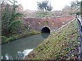
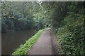
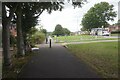
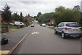
Photos of B14 6NF

Area Information
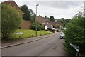
Living in B14 6NF places you in a small, defined residential cluster within Birmingham’s Brandwood & King’s Heath Ward. With a population of 1,871, this area reflects a suburban character shaped by historical development. Originally heathland under local manors, it evolved with 19th-century road improvements and housing expansions, avoiding the worst of 19th-century slum conditions. Today, it is part of the Birmingham Selly Oak constituency, blending quiet residential streets with proximity to urban amenities. The area’s compact size means daily life is centred around nearby retail, transport hubs, and community spaces. Residents benefit from a mix of historic sites, such as the Hare and Hounds pub, and practical infrastructure like rail stations. While not a densely populated zone, it offers a sense of locality with a population skewed toward adults aged 30–64, suggesting a community of established residents rather than transient populations. Its position south of the city centre ensures access to Birmingham’s broader networks without the congestion of central areas.
- Area Type
- Postcode
- Area Size
- Not available
- Population
- 1871
- Population Density
- 3781 people/km²
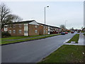
The property market in B14 6NF is characterised by a 53% home ownership rate, with houses forming the predominant accommodation type. This suggests a market skewed toward owner-occupied properties rather than a rental-heavy area, though nearly half of properties may be rented. The prevalence of houses indicates a focus on family homes, possibly with larger gardens or more spacious layouts compared to flats. Given the area’s small size and defined postcode boundaries, property availability is likely limited to a few hundred homes, creating a niche market for buyers. The compact nature of the area means that property values could be influenced by proximity to nearby amenities such as rail stations and schools. For buyers, this suggests a need to consider not only the immediate postcode but also surrounding areas for a broader range of options. The mix of ownership and rental properties may also reflect a balance between long-term residents and those seeking more affordable housing in a suburban setting.
House Prices in B14 6NF
No properties found in this postcode.
Energy Efficiency in B14 6NF
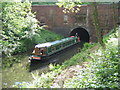
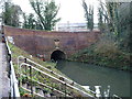
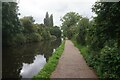
The lifestyle in B14 6NF is shaped by its proximity to retail, dining, and transport hubs. Within walking distance are five retail outlets, including Spar, Tesco Kings, and Co-op Kings, offering everyday essentials. While the area does not list specific dining venues, the presence of multiple supermarkets suggests a focus on convenience over high-end eateries. The nearby rail and metro stations provide access to Birmingham’s wider leisure and cultural offerings, from shopping centres to parks and museums. Historically, the area features sites like the Hare and Hounds pub, a 19th-century landmark, and Brandwood End Cemetery, reflecting its heritage. However, the data does not mention parks or recreational spaces, so residents may need to travel slightly further for green spaces. Overall, the lifestyle balances suburban tranquillity with urban accessibility, though the lack of detailed information on leisure facilities means potential residents should explore nearby areas for full recreational options.
Amenities
Schools
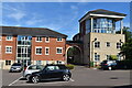
Residents of B14 6NF have access to two named schools within close proximity. Allens Croft Nursery School provides early education, while Allens Croft Primary School serves children aged 4–11. The primary school holds an Ofsted rating of satisfactory, indicating it meets minimum standards but may not excel in areas such as pupil outcomes or staff performance. The presence of both a nursery and primary school offers a seamless educational pathway for young families, reducing the need to travel further for schooling. However, the absence of secondary schools or specialist institutions within the area means parents may need to consider nearby post-primary options. The mix of school types reflects a focus on early education and foundational learning, which is typical for suburban areas with smaller populations. For families prioritising school quality, additional research into nearby secondary schools would be necessary to ensure a full educational spectrum.
| Rank | School | Type | Entry gender | Ages |
|---|---|---|---|---|
| 1 | Allens Croft Nursery School | nursery | N/A | N/A |
| 2 | Allens Croft Primary School | primary | N/A | N/A |
Explore more schools in this area
Go to Schools tabDemographics
The demographic profile of B14 6NF is defined by a median age of 47, with the majority of residents falling within the 30–64 age range. This suggests a community of middle-aged adults, likely with established careers and families. Home ownership stands at 53%, indicating a moderate balance between owner-occupied and rental properties. The predominant accommodation type is houses, reflecting a more traditional residential layout compared to flats or apartments. The dominant ethnic group is White, which aligns with broader trends in Birmingham’s suburban wards. While no specific deprivation data is provided, the age profile and home ownership rate imply a stable, settled population with fewer transient residents. This demographic structure may influence local services and amenities, tailored to the needs of adults rather than children or elderly populations. The absence of detailed diversity statistics means the area’s cultural composition remains less specified, but it is unlikely to be highly diverse given the predominant ethnic group.
Household Size
Accommodation Type
Tenure
Ethnic Group
Religion
Household Composition
Age
Household Deprivation
NS-SEC
Explore more demographic insights in this area
Go to Demographics tabPlanning
Planning Constraints
- Flood RiskPremium
- Ramsar Wetland SitesPremium
- Area of Outstanding Natural BeautyPremium
- Protected Nature ReservePremium
- Protected WoodlandPremium
- Crime RiskPremium