Area Overview for B14 6HS
Photos of B14 6HS

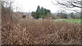
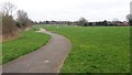
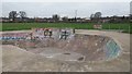
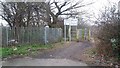
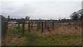
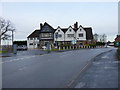
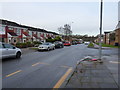
24 photos from this area
Area Information
Key information about the B14 6HS including its size, population, and administrative classification.
- Area Type
- Postcode
- Area Size
- 5796 m²
- Population
- Not available
- Population Density
- Not available
House Prices in B14 6HS
20
Properties
£127,164
Average Sold Price
£55,300
Lowest Price
£215,000
Highest Price
Showing 20 properties
| Address | Type | Beds | Baths | Last Sale Price | Last Sale Date | |
|---|---|---|---|---|---|---|
| 8 Frome Way, Birmingham, B14 6HS | house | - | - | £215,000 | Jul 2021 | |
| 1 Frome Way, Birmingham, B14 6HS | Terraced | 1 | 1 | £147,500 | Nov 2016 | |
| 9 Frome Way, Birmingham, B14 6HS | Terraced | - | - | £145,000 | Feb 2016 | |
| 5 Frome Way, Birmingham, B14 6HS | Terraced | 3 | - | £148,000 | Mar 2015 | |
| 6 Frome Way, Birmingham, B14 6HS | Semi-detached | 3 | 1 | £140,000 | Jan 2015 | |
| 19 Frome Way, Birmingham, B14 6HS | house | 3 | - | £105,000 | Jun 2012 | |
| 16 Frome Way, Birmingham, B14 6HS | house | - | - | £107,000 | Jan 2011 | |
| 21 Frome Way, Birmingham, B14 6HS | Terraced | 3 | 1 | £140,000 | Apr 2008 | |
| 15 Frome Way, Birmingham, B14 6HS | Terraced | - | - | £80,000 | Apr 2007 | |
| 11 Frome Way, Birmingham, B14 6HS | house | - | - | £116,000 | Aug 2006 |
Page 1 of 2
Energy Efficiency in B14 6HS
Amenities
Schools
| Rank | School | Type | Entry gender | Ages |
|---|
Explore more schools in this area
Go to Schools tabDemographics
Household Size
One person
most common
Accommodation Type
Houses
most common
Tenure
47
majority
Ethnic Group
White
most common
Religion
N/A
most common
Household Composition
N/A
most common
Age
47
median
Adults (30-64 years)
most common
Household Deprivation
N/A
with no deprivation
NS-SEC
25
in Lower managerial occupations
Explore more demographic insights in this area
Go to Demographics tabPlanning
Planning Constraints
- Flood RiskPremium
- Ramsar Wetland SitesPremium
- Area of Outstanding Natural BeautyPremium
- Protected Nature ReservePremium
- Protected WoodlandPremium