Area Overview for B14 6DU
Photos of B14 6DU

Area Information
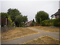
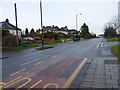
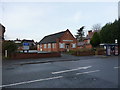
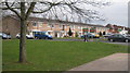
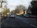
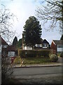
B14 6DU is a small residential postcode in England, nestled within the suburban ward of Brandwood & King’s Heath in Birmingham. With a population of just 1,806, it reflects a quiet, tightly knit community. The area’s character stems from its historical roots as heathland, transformed by 18th-century road improvements and gradual development into a residential hub. Today, it offers a blend of older housing stock and established infrastructure. Daily life here is shaped by proximity to key transport links, including nearby railway stations and metro stops, which connect residents to Birmingham’s city centre and beyond. The area’s low crime risk and absence of environmental constraints like protected woodlands or wetlands make it an attractive option for those seeking a stable, low-maintenance lifestyle. Its compact size means amenities are within practical reach, from local shops to public transport, fostering a sense of convenience. While not a high-density urban area, B14 6DU provides a balance between suburban tranquillity and access to city resources, appealing to those who value both.
- Area Type
- Postcode
- Area Size
- Not available
- Population
- 1806
- Population Density
- 5314 people/km²
B14 6DU is predominantly an owner-occupied area, with 80% of homes owned by residents rather than rented. The accommodation type is primarily houses, which is unusual for a small postcode area but suggests a focus on detached or semi-detached properties. This housing stock likely contributes to a more stable and established property market, with limited turnover. The compact size of the area means that properties are likely to be in close proximity to each other, creating a cohesive neighbourhood with shared characteristics. For buyers, this could mean a market where homes are well-maintained and reflect the area’s historical development. However, the small scale of the area may limit availability, requiring buyers to consider nearby postcodes for a broader selection. The high home ownership rate also indicates that the area is less reliant on rental demand, potentially reducing competition from investors.
House Prices in B14 6DU
No properties found in this postcode.
Energy Efficiency in B14 6DU
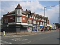
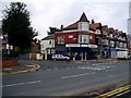
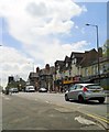
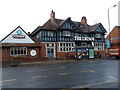
Residents of B14 6DU have access to a range of amenities within practical reach. Local retail options include Tesco Kings, Sainsburys Kings, and Co-op Kings, providing essential shopping needs. The area’s proximity to railway stations like Bournville and Yardley Wood, as well as metro stops such as Edgbaston Village, ensures convenient access to Birmingham’s broader network. While specific details on parks or leisure facilities are not provided, the historical presence of sites like Brandwood End Cemetery and the Hare and Hounds pub suggests a mix of green spaces and community landmarks. The area’s compact nature means that daily errands and social activities can be managed without long journeys, contributing to a practical and connected lifestyle. The combination of retail, transport, and historical features creates a balanced environment where convenience meets local character.
Amenities
Schools
| Rank | School | Type | Entry gender | Ages |
|---|
Explore more schools in this area
Go to Schools tabDemographics
The population of B14 6DU is 1,806, with a median age of 47, indicating a mature demographic. The most common age range is adults aged 30–64, suggesting a community of established professionals and families. Home ownership is high at 80%, with the predominant accommodation type being houses. This reflects a residential area where long-term occupancy is common. The predominant ethnic group is White, though specific data on diversity or deprivation is not provided. The age profile implies a stable, low-turnover population, which can contribute to a cohesive community feel. With no data on household types or income levels, it is reasonable to infer that the area may lean towards middle-income families seeking a settled environment. The absence of significant demographic diversity or deprivation metrics means the area’s social fabric is likely uniform, with limited variation in lifestyle or economic status.
Household Size
Accommodation Type
Tenure
Ethnic Group
Religion
Household Composition
Age
Household Deprivation
NS-SEC
Explore more demographic insights in this area
Go to Demographics tabPlanning
Planning Constraints
- Flood RiskPremium
- Ramsar Wetland SitesPremium
- Area of Outstanding Natural BeautyPremium
- Protected Nature ReservePremium
- Protected WoodlandPremium