Area Overview for B14 6AW
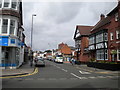
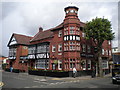
Photos of B14 6AW


Area Information
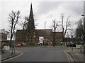
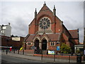
B14 6AW is a small residential cluster in England’s West Midlands, nestled within the broader Brandwood & King’s Heath Ward of Birmingham. With a population of 1,534, it reflects a quiet suburban character shaped by historical development along the Alcester to Birmingham road. The area’s origins trace back to 18th-century heathland, later transformed by enclosures and 19th-century housing expansions. Today, it offers a compact, low-density living environment with a strong sense of local identity. Residents benefit from proximity to key transport links, including multiple railway stations and metro stops, while the area’s historical sites—such as the Hare and Hounds pub and Brandwood House—add cultural depth. The community is largely composed of adults aged 30–64, with a high rate of home ownership. Daily life here balances practicality with heritage, supported by nearby retail options, schools, and green spaces. Its strategic location near Birmingham’s core, yet distinct from its urban intensity, makes B14 6AW appealing to those seeking a stable, family-oriented environment with easy access to city amenities.
- Area Type
- Postcode
- Area Size
- Not available
- Population
- Not available
- Population Density
- Not available
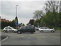
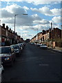
B14 6AW is primarily an owner-occupied area, with 81% of homes owned by residents rather than rented. The accommodation type is predominantly houses, which is typical of suburban settings and contrasts with urban areas where flats dominate. This suggests a housing stock characterised by single-family homes, likely offering more space and privacy than city-centre properties. The small postcode area’s limited size means the housing market is tightly focused, with properties concentrated around key roads like Drayton and Goldsmith Roads, developed in the 1890s. For buyers, this implies a niche market where availability is restricted, and properties are likely to be in established, well-maintained condition. The high home ownership rate also indicates a stable demand for residential property, with little turnover. Prospective buyers should consider the area’s proximity to transport links and amenities as key selling points, given its suburban charm and practical connectivity.
House Prices in B14 6AW
No properties found in this postcode.
Energy Efficiency in B14 6AW
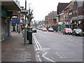
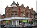
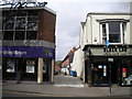
Living in B14 6AW offers a blend of practicality and local character, with amenities within practical reach. Retail options include Sainsburys Kings, Co-op Kings, and Lidl Moseley, providing everyday shopping needs. The area’s transport links extend to multiple railway stations and metro stops, such as Bournville and Edgbaston Village, facilitating easy access to Birmingham’s cultural and commercial centres. While specific parks or leisure facilities are not detailed in the data, historical sites like the Hare and Hounds pub and Brandwood End Cemetery suggest a community rooted in heritage. The presence of schools, though not named, is implied by the area’s family-oriented demographic. Residents benefit from a quiet suburban atmosphere, with the convenience of nearby retail, transport, and historical landmarks contributing to a sense of place. This balance of accessibility and local identity makes daily life in B14 6AW both functional and enriched by its historical context.
Amenities
Schools
| Rank | School | Type | Entry gender | Ages |
|---|
Explore more schools in this area
Go to Schools tabDemographics
The population of B14 6AW has a median age of 47, with the majority of residents falling within the 30–64 age range. This suggests a mature, established community with a focus on stability and long-term residency. Home ownership is high at 81%, indicating a strong preference for private property over rental housing. The predominant accommodation type is houses, reflecting a suburban layout with individual dwellings rather than high-density flats. The predominant ethnic group is White, though specific diversity metrics are not detailed in the data. The absence of significant deprivation indicators aligns with the area’s low crime risk and practical amenities. This demographic profile suggests a community prioritising security, family life, and long-term investment in property. The age distribution and ownership rates imply a population likely engaged in professional or semi-retired roles, with limited reliance on transient or rental-based housing.
Household Size
Accommodation Type
Tenure
Ethnic Group
Religion
Household Composition
Age
Household Deprivation
NS-SEC
Explore more demographic insights in this area
Go to Demographics tabPlanning
Planning Constraints
- Flood RiskPremium
- Ramsar Wetland SitesPremium
- Area of Outstanding Natural BeautyPremium
- Protected Nature ReservePremium
- Protected WoodlandPremium