Area Overview for B14 6AF
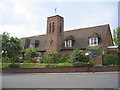
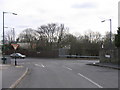
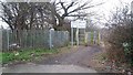
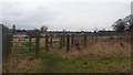
Photos of B14 6AF


Area Information
Living in B14 6AF means being part of a small, tightly knit residential cluster in England’s West Midlands. With a population of just 1,588, this postcode area offers a quiet, suburban lifestyle, distinct from the city’s bustling core. Situated in Brandwood & King’s Heath Ward, it lies within Birmingham’s Selly Oak constituency, historically shaped by 18th-century road improvements and 19th-century housing developments. The area’s character is defined by its mature community, with a median age of 47 and a strong presence of owner-occupied homes (83%). Most residents are adults aged 30–64, reflecting a stable, family-oriented demographic. Daily life here is grounded in local amenities, historic sites like Brandwood House, and proximity to transport hubs. While it avoids the congestion of urban centres, it remains within reach of Birmingham’s cultural and economic heart, offering a balance of tranquillity and accessibility.
- Area Type
- Postcode
- Area Size
- Not available
- Population
- 1588
- Population Density
- 4347 people/km²
The property market in B14 6AF is dominated by owner-occupied homes, with 83% of residents living in houses rather than flats or rental properties. This suggests a stable, long-term presence of families and individuals who have invested in their homes. The area’s housing stock is likely characterised by traditional suburban dwellings, reflecting its historical development as a 19th-century residential cluster. Given the small population and limited area, the market may be niche, with limited new builds or rental options. Buyers should consider the proximity to Birmingham’s urban centres, as the area’s immediate surroundings offer more extensive property choices. For those seeking a quiet, established home with strong community ties, B14 6AF provides a viable option, though its small size may require flexibility in location preferences.
House Prices in B14 6AF
No properties found in this postcode.
Energy Efficiency in B14 6AF
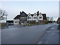
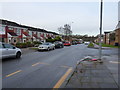
The lifestyle in B14 6AF is enriched by its proximity to a range of amenities. Locally, residents can access five retail outlets, including Tesco Kings, Co-op Kings, and Spar, ensuring everyday shopping needs are met. The area’s transport links connect it to Birmingham’s broader network, with rail stations like Bournville and Yardley Wood offering easy access to the city’s cultural and economic centres. Metro stations such as Grand Central New Street and Centenary Square further expand mobility. Historically, the area has been shaped by landmarks like the Hare and Hounds pub and Brandwood End Cemetery, adding a layer of local heritage. While the immediate vicinity lacks large parks or leisure facilities, the area’s suburban character and quiet streets offer a relaxed pace of life, complemented by the convenience of nearby urban amenities.
Amenities
Schools
Residents of B14 6AF have access to two primary schools within practical reach: Colmore Infant and Nursery School, which holds an Ofsted rating of outstanding, and Colmore Junior School, rated good. These institutions provide a seamless educational pathway for young children, with the infant school catering to early years and the junior school offering continued primary education. The presence of both schools in close proximity reduces the need for long commutes and supports family-focused living. The high Ofsted ratings suggest strong academic performance and effective teaching, which are critical factors for parents prioritising quality education. While secondary school options are not detailed in the data, the area’s proximity to Birmingham’s broader network likely ensures access to a range of further education institutions.
| Rank | School | Type | Entry gender | Ages |
|---|
Explore more schools in this area
Go to Schools tabDemographics
The community in B14 6AF is predominantly composed of adults aged 30–64, with a median age of 47. This suggests a mature population, likely with established careers and families. Home ownership is high, with 83% of residents owning their homes, indicating a stable housing market. The area is characterised by houses rather than flats, which aligns with its suburban, low-density layout. The predominant ethnic group is White, reflecting the broader demographic trends in the region. While specific data on deprivation is not provided, the high home ownership rate and absence of significant planning constraints suggest a relatively affluent community. However, the area’s small size and limited amenities may pose challenges for those requiring extensive services. The presence of two primary schools with strong Ofsted ratings indicates a focus on family life, reinforcing the area’s appeal to settled households.
Household Size
Accommodation Type
Tenure
Ethnic Group
Religion
Household Composition
Age
Household Deprivation
NS-SEC
Explore more demographic insights in this area
Go to Demographics tabPlanning
Planning Constraints
- Flood RiskPremium
- Ramsar Wetland SitesPremium
- Area of Outstanding Natural BeautyPremium
- Protected Nature ReservePremium
- Protected WoodlandPremium