Area Overview for B14 5YN
Photos of B14 5YN


Area Information
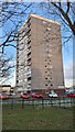
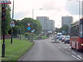
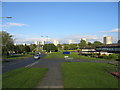
B14 5YN is a small residential cluster in Birmingham’s Druids Heath area, home to 1,581 people. Situated west of the Maypole, it lies within a postwar housing estate originally built on farmland to address Birmingham’s population growth. The area is part of a larger ward with a population of 11,645, but B14 5YN itself is a distinct, compact postcode. Its character is shaped by mid-20th-century architecture, including seven tower blocks and older housing stock. The median age of residents is 47, with adults aged 30–64 forming the largest demographic group. While the area has historically faced challenges such as deprivation and crime, it offers proximity to key amenities like Bells Farm Primary School and multiple rail stations. Redevelopment plans are underway, aiming to replace 1,000 council homes with mixed-tenure housing and green spaces. For buyers, this area balances affordability with the need for practical upgrades, though its small size means limited housing options.
- Area Type
- Postcode
- Area Size
- Not available
- Population
- 1581
- Population Density
- 4690 people/km²
B14 5YN’s property market is defined by its 46% home ownership rate, indicating that over half of residents rent their homes. The area’s accommodation type is primarily houses, though the housing stock includes 1960s tower blocks and postwar developments. This mix suggests limited availability of newer properties, with many homes requiring renovation or modernization. The small postcode area means buyers have few options within B14 5YN itself, though nearby zones may offer more variety. The redevelopment plans for Druids Heath, set to replace 1,000 council homes with mixed-tenure housing, could reshape the market in the coming years. For now, the area remains a rental-heavy zone with modest property values, but buyers should consider the potential for future changes and the need for maintenance in older homes.
House Prices in B14 5YN
No properties found in this postcode.
Energy Efficiency in B14 5YN
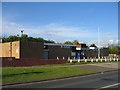
The lifestyle in B14 5YN is shaped by its proximity to retail, transport, and nearby districts. Within walking distance, residents can access shops like Spar, Co-op Kings, and Iceland Maypole, offering basic grocery and convenience needs. The area’s rail stations connect to Birmingham’s broader retail and leisure networks, including Edgbaston Village and Grand Central New Street. While the postcode itself lacks large commercial centres, the surrounding zones provide access to dining, entertainment, and services. The character of daily life is influenced by the area’s postwar housing stock and ongoing redevelopment plans, which may introduce new facilities in the future. For now, the lifestyle is practical but limited, with a focus on essential amenities and transport links. The mix of retail options and transport connectivity means residents can meet daily needs without long commutes, though the area’s urban setting may lack green spaces or high-end leisure options.
Amenities
Schools
The nearest school to B14 5YN is Bells Farm Primary School, which serves the area’s younger residents. Rated as “good” by Ofsted, it provides primary education for children in the locality. While no secondary schools are listed in the data, the presence of a well-rated primary school is a key factor for families prioritizing education. The school’s proximity to the area’s housing stock suggests it is a central hub for local children. However, the absence of secondary school options within the postcode means families may need to consider commuting to nearby districts for secondary education. This dynamic could influence housing decisions, particularly for families with older children. The school’s performance reflects a baseline of quality, though further details on its curriculum or facilities are not provided.
| Rank | School | Type | Entry gender | Ages |
|---|
Explore more schools in this area
Go to Schools tabDemographics
The population of B14 5YN is 1,581, with a median age of 47. The majority of residents are adults aged 30–64, reflecting a mature community. Home ownership stands at 46%, below the national average, suggesting a significant rental market. The predominant accommodation type is houses, though the area’s 1960s tower blocks and older housing contribute to a mix of property types. The White ethnic group is the largest demographic, though specific diversity statistics are not provided. The area ranks among Birmingham’s most deprived, with a 31.6% child poverty rate and 25.4% of working-age residents lacking NVQ4+ qualifications. This context means residents may face higher rates of unemployment and limited access to high-skilled employment. The ward’s 31st highest share of unqualified working-age adults and above-average claimant unemployment further underscore socioeconomic challenges, which can impact local services and quality of life.
Household Size
Accommodation Type
Tenure
Ethnic Group
Religion
Household Composition
Age
Household Deprivation
NS-SEC
Explore more demographic insights in this area
Go to Demographics tabPlanning
Planning Constraints
- Flood RiskPremium
- Ramsar Wetland SitesPremium
- Area of Outstanding Natural BeautyPremium
- Protected Nature ReservePremium
- Protected WoodlandPremium