Area Overview for B14 5TS
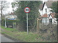
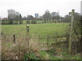
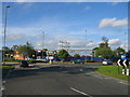
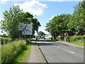
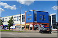
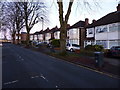
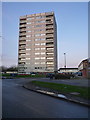
Photos of B14 5TS
Area Information
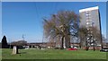
B14 5TS lies within the Highter’s Heath district, a historically significant area on Birmingham’s southern edge. With a population of 1,439, it is a compact residential cluster encompassing parts of Warstock, Maypole, and Yardley Wood. The area developed as a suburban extension in the late 19th and early 20th centuries, avoiding the industrial squalor that marked much of Birmingham’s growth. Today, it is characterised by a mature community, with a median age of 47 and a majority of residents aged 30–64. The area’s small size and low population density create a quiet, neighbourhood-focused atmosphere. Its proximity to Maypole Lane and Highter’s Heath Lane, along with historical references to the district’s name, adds a layer of local identity. Residents benefit from being near key transport hubs and retail centres, while the area’s history as a healthier alternative to industrialised zones persists in its character. This is a place where suburban stability meets practical accessibility, ideal for those seeking a balanced lifestyle in Birmingham’s outer reaches.
- Area Type
- Postcode
- Area Size
- Not available
- Population
- 1439
- Population Density
- 5535 people/km²
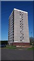
The property market in B14 5TS is dominated by owner-occupied homes, with 81% of properties owned outright. This high home ownership rate indicates a stable, long-term resident base rather than a rental-heavy market. The accommodation type is primarily houses, suggesting a mix of semi-detached and detached properties typical of suburban areas. Given the area’s small size and population of 1,439, the housing stock is limited, meaning buyers may need to consider nearby wards such as Warstock or Yardley Wood for more options. The focus on owner-occupied housing implies lower turnover and a community-oriented environment. For buyers, this means properties are likely to be well-maintained and hold value, but competition for available homes could be fierce. The absence of high-density housing or flats reflects the area’s traditional suburban character, appealing to those seeking space and stability.
House Prices in B14 5TS
No properties found in this postcode.
Energy Efficiency in B14 5TS
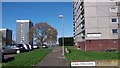
Living in B14 5TS offers access to a range of practical amenities within walking or short driving distance. Retail options include Sainsburys Maypole, Aldi Warstock, and Iceland Maypole, providing everyday shopping convenience. The area’s proximity to rail and metro stations—such as Whitlocks End and Edgbaston Village—ensures easy access to Birmingham’s transport network, linking residents to cultural hubs, workplaces, and leisure opportunities. Locally, Hollywood Primary School and Immanuel Church add to the community’s character, offering education and social spaces. While the area lacks large parks or recreational facilities, its suburban layout and nearby green spaces—such as Major’s Green—provide opportunities for outdoor activities. The mix of retail, transport, and local institutions creates a self-contained lifestyle, balancing practicality with the amenities needed for daily life.
Amenities
Schools
| Rank | School | Type | Entry gender | Ages |
|---|
Explore more schools in this area
Go to Schools tabDemographics
The community in B14 5TS is predominantly composed of adults aged 30–64, with a median age of 47. This suggests a mature, established population, likely with long-term ties to the area. Home ownership is high at 81%, reflecting a stable, owner-occupied demographic. The accommodation type is primarily houses, indicating a mix of family homes and single-occupancy properties. The predominant ethnic group is White, though no specific data on diversity or deprivation is provided. The age profile and home ownership rates suggest a community focused on long-term residency, with fewer transient populations. The absence of detailed diversity statistics means the area’s social composition remains largely unexplored in the data, but the high home ownership rate implies a degree of economic stability. This demographic profile aligns with the area’s historical role as a middle-class suburb, where professional and artisan families have settled over decades.
Household Size
Accommodation Type
Tenure
Ethnic Group
Religion
Household Composition
Age
Household Deprivation
NS-SEC
Explore more demographic insights in this area
Go to Demographics tabPlanning
Planning Constraints
- Flood RiskPremium
- Ramsar Wetland SitesPremium
- Area of Outstanding Natural BeautyPremium
- Protected Nature ReservePremium
- Protected WoodlandPremium
- Crime RiskPremium