Area Overview for B14 5SN
Photos of B14 5SN
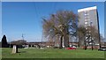
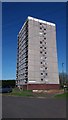
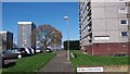
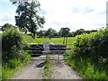
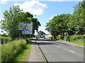
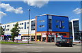
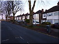
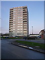
41 photos from this area
Area Information
Key information about the B14 5SN including its size, population, and administrative classification.
- Area Type
- Postcode
- Area Size
- 9507 m²
- Population
- 1405
- Population Density
- 6429 people/km²
House Prices in B14 5SN
25
Properties
£132,669
Average Sold Price
£12,235
Lowest Price
£230,000
Highest Price
Showing 25 properties
| Address | Type | Beds | Baths | Last Sale Price | Last Sale Date | |
|---|---|---|---|---|---|---|
| 40 Druids Lane, Birmingham, B14 5SN | Terraced | 3 | 1 | £95,000 | Mar 2024 | |
| 26 Druids Lane, Birmingham, B14 5SN | Terraced | 3 | 1 | £230,000 | Feb 2024 | |
| 32 Druids Lane, Birmingham, B14 5SN | house | - | - | £180,000 | Oct 2023 | |
| 28 Druids Lane, Birmingham, B14 5SN | Terraced | - | - | £12,235 | Feb 2023 | |
| 50 Druids Lane, Birmingham, B14 5SN | house | - | - | £195,000 | Feb 2021 | |
| 58 Druids Lane, Birmingham, B14 5SN | house | - | - | £170,000 | Jan 2021 | |
| 20 Druids Lane, Birmingham, B14 5SN | Terraced | 3 | 1 | £170,000 | Feb 2020 | |
| 60 Druids Lane, Birmingham, B14 5SN | Terraced | 3 | 1 | £178,000 | Feb 2019 | |
| 52 Druids Lane, Birmingham, B14 5SN | Terraced | 3 | 1 | £179,000 | Nov 2018 | |
| 62 Druids Lane, Birmingham, B14 5SN | Detached | 3 | 1 | £181,000 | Feb 2018 |
Page 1 of 3
Energy Efficiency in B14 5SN
Amenities
Schools
| Rank | School | Type | Entry gender | Ages |
|---|
Explore more schools in this area
Go to Schools tabDemographics
Household Size
One person
most common
Accommodation Type
Flats
most common
Tenure
14
majority
Ethnic Group
White
most common
Religion
N/A
most common
Household Composition
N/A
most common
Age
47
median
Adults (30-64 years)
most common
Household Deprivation
N/A
with no deprivation
NS-SEC
8
in Lower managerial occupations
Explore more demographic insights in this area
Go to Demographics tabPlanning
Planning Constraints
- Flood RiskPremium
- Ramsar Wetland SitesPremium
- Area of Outstanding Natural BeautyPremium
- Protected Nature ReservePremium
- Protected WoodlandPremium