Area Overview for B14 5QD
Photos of B14 5QD
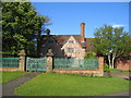
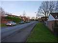
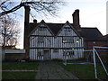
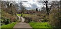
16 photos from this area
Area Information
Key information about the B14 5QD including its size, population, and administrative classification.
- Area Type
- Postcode
- Area Size
- 6716 m²
- Population
- 1581
- Population Density
- 4690 people/km²
House Prices in B14 5QD
27
Properties
£84,800
Average Sold Price
£26,000
Lowest Price
£130,000
Highest Price
Showing 27 properties
| Address | Type | Beds | Baths | Last Sale Price | Last Sale Date | |
|---|---|---|---|---|---|---|
| 15 Oatlands Walk, Birmingham, B14 5QD | Flat | - | - | £75,000 | Sep 2022 | |
| 27 Oatlands Walk, Birmingham, B14 5QD | Terraced | 3 | 1 | £125,000 | Jun 2021 | |
| 43 Oatlands Walk, Birmingham, B14 5QD | house | 3 | 1 | £127,000 | Mar 2020 | |
| 7 Oatlands Walk, Birmingham, B14 5QD | Terraced | 3 | 1 | £130,000 | Oct 2019 | |
| 49 Oatlands Walk, Birmingham, B14 5QD | house | 3 | - | £105,000 | Dec 2018 | |
| 11 Oatlands Walk, Birmingham, B14 5QD | Terraced | 3 | - | £80,000 | Mar 2016 | |
| 53 Oatlands Walk, Birmingham, B14 5QD | house | - | - | £80,000 | May 2014 | |
| 33 Oatlands Walk, Birmingham, B14 5QD | house | 3 | - | £65,000 | Jul 2011 | |
| 47 Oatlands Walk, Birmingham, B14 5QD | Terraced | 3 | 1 | £26,000 | Jan 2007 | |
| 41 Oatlands Walk, Birmingham, B14 5QD | Terraced | - | - | £35,000 | Aug 1997 |
Page 1 of 3
Energy Efficiency in B14 5QD
Amenities
Schools
| Rank | School | Type | Entry gender | Ages |
|---|
Explore more schools in this area
Go to Schools tabDemographics
Household Size
One person
most common
Accommodation Type
Houses
most common
Tenure
46
majority
Ethnic Group
White
most common
Religion
N/A
most common
Household Composition
N/A
most common
Age
47
median
Adults (30-64 years)
most common
Household Deprivation
N/A
with no deprivation
NS-SEC
15
in Lower managerial occupations
Explore more demographic insights in this area
Go to Demographics tabPlanning
Planning Constraints
- Flood RiskPremium
- Ramsar Wetland SitesPremium
- Area of Outstanding Natural BeautyPremium
- Protected Nature ReservePremium
- Protected WoodlandPremium