Area Overview for B14 5NX
Photos of B14 5NX
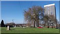
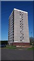
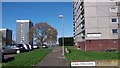
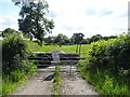
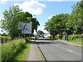
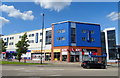
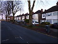
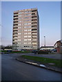
41 photos from this area
Area Information
Key information about the B14 5NX including its size, population, and administrative classification.
- Area Type
- Postcode
- Area Size
- 9656 m²
- Population
- 1539
- Population Density
- 4274 people/km²
House Prices in B14 5NX
27
Properties
£101,470
Average Sold Price
£47,950
Lowest Price
£143,000
Highest Price
Showing 27 properties
| Address | Type | Beds | Baths | Last Sale Price | Last Sale Date | |
|---|---|---|---|---|---|---|
| 17 Saxelby Close, Birmingham, B14 5NX | Terraced | 3 | 2 | £143,000 | Jul 2021 | |
| 29 Saxelby Close, Birmingham, B14 5NX | Terraced | 1 | 1 | £118,000 | Jul 2020 | |
| 15 Saxelby Close, Birmingham, B14 5NX | Terraced | 3 | 1 | £102,000 | Feb 2020 | |
| 23 Saxelby Close, Birmingham, B14 5NX | Terraced | 3 | 1 | £125,750 | Aug 2018 | |
| 9 Saxelby Close, Birmingham, B14 5NX | Terraced | 3 | 1 | £111,500 | Aug 2017 | |
| 27 Saxelby Close, Birmingham, B14 5NX | house | - | - | £95,000 | Dec 2015 | |
| 14 Saxelby Close, Birmingham, B14 5NX | Terraced | 3 | - | £92,500 | Dec 2012 | |
| 21 Saxelby Close, Birmingham, B14 5NX | Terraced | - | - | £90,000 | Dec 2009 | |
| 11 Saxelby Close, Birmingham, B14 5NX | house | - | - | £89,000 | Jun 2005 | |
| 25 Saxelby Close, Birmingham, B14 5NX | Terraced | - | - | £47,950 | Dec 2001 |
Page 1 of 3
Energy Efficiency in B14 5NX
Amenities
Schools
| Rank | School | Type | Entry gender | Ages |
|---|
Explore more schools in this area
Go to Schools tabDemographics
Household Size
Family (3-5 people)
most common
Accommodation Type
Houses
most common
Tenure
52
majority
Ethnic Group
White
most common
Religion
N/A
most common
Household Composition
N/A
most common
Age
47
median
Adults (30-64 years)
most common
Household Deprivation
N/A
with no deprivation
NS-SEC
16
in Lower managerial occupations
Explore more demographic insights in this area
Go to Demographics tabPlanning
Planning Constraints
- Flood RiskPremium
- Ramsar Wetland SitesPremium
- Area of Outstanding Natural BeautyPremium
- Protected Nature ReservePremium
- Protected WoodlandPremium