Area Overview for B14 5LZ
Photos of B14 5LZ


Area Information
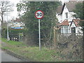
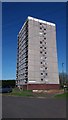
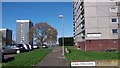
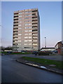
Living in B14 5LZ, a small residential cluster in Birmingham’s Druids Heath & Monyhull ward, means inhabiting a historically significant but evolving part of the city. The area, with a population of 1,712, sits west of the Maypole and was built postwar on farmland to meet Birmingham’s housing needs. It is characterised by a mix of 1960s tower blocks and houses, though redevelopment plans from 2025 aim to replace over 1,000 council homes with mixed-tenure housing and green spaces. Daily life here is shaped by proximity to retail hubs like Iceland Maypole and Sainsburys, as well as rail and metro stations offering links to Birmingham’s city centre and beyond. The community, with a median age of 47, skews toward adults aged 30–64, reflecting a mature demographic. While the area is ranked among Birmingham’s most deprived, its infrastructure—such as The Oaks Primary School and transport networks—offers practical convenience for residents navigating the city’s challenges.
- Area Type
- Postcode
- Area Size
- Not available
- Population
- 1712
- Population Density
- 5492 people/km²
The property market in B14 5LZ is dominated by rental housing, with only 41% of homes owner-occupied. The accommodation type is primarily houses, though the area is known for its 1960s tower blocks, which form part of a larger postwar housing estate. This mix of housing stock reflects both historical planning and current redevelopment plans, which aim to replace over 1,000 council homes with mixed-tenure housing. For buyers, the small size of the postcode area means limited options, but proximity to rail and metro stations—such as Kings Norton and Edgbaston Village—offers connectivity to Birmingham’s broader housing market. The presence of both older properties and planned regeneration creates a dynamic landscape, though potential buyers should consider the area’s challenges, including its deprivation ranking and the potential for future changes to the housing stock.
House Prices in B14 5LZ
No properties found in this postcode.
Energy Efficiency in B14 5LZ
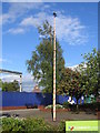
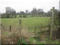
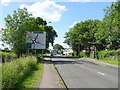
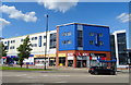
Residents of B14 5LZ have access to a range of nearby amenities, including retail outlets like Iceland Maypole, Aldi Warstock, and Sainsburys Maypole, which cater to daily shopping needs. The area’s rail and metro stations—Kings Norton, Yardley Wood, and Edgbaston Village—offer convenient links to Birmingham’s city centre and beyond, supporting both commuting and leisure travel. While the immediate area lacks major parks or green spaces, the broader Druids Heath ward includes historical sites and redevelopment projects that may enhance future recreational options. The presence of The Oaks Primary School and nearby transport hubs contributes to a functional, if modest, lifestyle. However, the area’s character—marked by older housing stock and ongoing redevelopment—means residents must balance practical amenities with the challenges of a historically deprived neighbourhood.
Amenities
Schools
The Oaks Primary School is the only named school listed for B14 5LZ, though it appears twice in the data. As a primary school, it serves the local community, though no Ofsted rating is provided. The lack of secondary schools in the immediate area means families may need to look further afield for comprehensive education. The presence of a single primary school suggests limited educational diversity, which could impact families prioritising a range of school types. While The Oaks Primary may meet basic needs, the absence of data on its performance or facilities leaves gaps in understanding its quality. For homebuyers, proximity to schools is a key consideration, and the current school options in B14 5LZ highlight the need for additional research into nearby secondary education opportunities.
| Rank | School | Type | Entry gender | Ages |
|---|---|---|---|---|
| 1 | The Oaks Primary School | primary | N/A | N/A |
| 2 | The Oaks Primary School | primary | N/A | N/A |
Explore more schools in this area
Go to Schools tabDemographics
The population of B14 5LZ is 1,712, with a median age of 47 and the most common age range being adults aged 30–64. Home ownership here is low at 41%, indicating a rental-dominated market. The accommodation type is primarily houses, though the area includes 1960s tower blocks, which contribute to its character. The predominant ethnic group is White, with no specific data on other demographics. The ward ranks 25th out of 69 in Birmingham for deprivation, with 31.6% child poverty and 25.4% of working-age residents lacking qualifications. This context means residents face challenges such as higher unemployment rates and limited access to high-skilled jobs, though the area’s proximity to transport links and retail amenities provides some counterbalance. The mix of older housing stock and ongoing redevelopment also shapes the lived experience of residents, particularly those in council homes.
Household Size
Accommodation Type
Tenure
Ethnic Group
Religion
Household Composition
Age
Household Deprivation
NS-SEC
Explore more demographic insights in this area
Go to Demographics tabPlanning
Planning Constraints
- Flood RiskPremium
- Ramsar Wetland SitesPremium
- Area of Outstanding Natural BeautyPremium
- Protected Nature ReservePremium
- Protected WoodlandPremium
- Crime RiskPremium