Area Overview for B14 5EQ
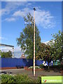
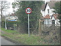
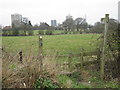
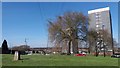
Photos of B14 5EQ

Area Information
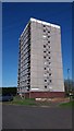
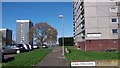
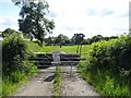
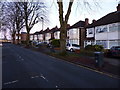
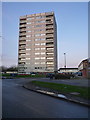
Living in B14 5EQ means inhabiting a small, tightly knit residential cluster within the Druids Heath area of Birmingham. With a population of 1,712, this postcode is part of a postwar housing estate built on former farmland, reflecting a chapter of Birmingham’s mid-20th-century expansion. The area is undergoing significant change, with plans to demolish existing 1960s tower blocks and replace them with mixed-tenure housing and green spaces. Daily life here is shaped by its urban character, with a focus on local amenities and transport links. The community is predominantly adult, with a median age of 47 and most residents falling within the 30-64 age range. While the area has historically faced challenges such as deprivation and crime, its proximity to rail and metro stations, coupled with strong broadband connectivity, offers practical advantages. The estate’s redevelopment hints at future transformation, though current residents navigate a mix of older housing stock and ongoing planning. For those considering B14 5EQ, it is a place of contrast: a working-class suburb with a legacy of postwar architecture, now at the cusp of renewal.
- Area Type
- Postcode
- Area Size
- Not available
- Population
- 1712
- Population Density
- 5492 people/km²
The property market in B14 5EQ is dominated by rental tenure, with only 41% of homes owned by residents. The area’s housing stock is largely composed of houses, though the estate also includes 1960s tower blocks, some of which are slated for demolition as part of a major redevelopment plan. This mix of housing types reflects the area’s postwar origins, with a focus on high-density, low-cost housing to meet Birmingham’s growing population. The planned redevelopment, which will replace over 1,000 council homes with mixed-tenure housing, suggests a shift toward more varied property options in the future. However, for current buyers, the small size of the area and its focus on older housing stock mean limited choice. The market is likely to remain rental-oriented, with property values influenced by the estate’s ongoing transformation. Prospective buyers should consider the area’s long-term planning, as redevelopment could significantly alter the local property landscape.
House Prices in B14 5EQ
No properties found in this postcode.
Energy Efficiency in B14 5EQ
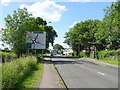
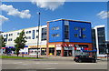
The lifestyle in B14 5EQ is shaped by its proximity to retail, transport, and local services. Within practical reach are supermarkets like Iceland Maypole, Aldi Warstock, and Sainsburys Maypole, offering everyday shopping convenience. The area’s rail and metro stations—Kings Norton, Yardley Wood, Bournville, Edgbaston Village, Grand Central New Street, and Centenary Square—provide easy access to Birmingham’s broader network, facilitating commutes to work, leisure, or shopping. While the data does not mention parks or leisure facilities, the planned redevelopment includes green spaces, which may enhance future recreational options. The existing infrastructure supports a functional daily life, with a focus on practicality over luxury. Residents must rely on nearby districts for more specialised amenities, but the current setup ensures basic needs are met. The character of the area is pragmatic, with a strong emphasis on connectivity and accessibility.
Amenities
Schools
The Oaks Primary School is the sole named school listed near B14 5EQ, though it appears twice in the data. This suggests it may be the primary educational institution serving the area. As a primary school, it caters to younger children, but no secondary schools are mentioned in the data. Families relying on local education would need to look beyond the immediate postcode for secondary options. The absence of secondary schools in the immediate vicinity may require parents to consider commuting or enrolling children in nearby districts. The single primary school available reflects the area’s limited educational infrastructure, which may be a consideration for families prioritising a range of school types. However, the presence of The Oaks Primary School provides a foundational educational resource for the community.
| Rank | School | Type | Entry gender | Ages |
|---|
Explore more schools in this area
Go to Schools tabDemographics
The community in B14 5EQ is predominantly middle-aged, with a median age of 47 and the most common age range being adults aged 30-64. Home ownership here is relatively low at 41%, indicating that the majority of residents are either renting or in other forms of tenure. The area is characterised by houses as the primary accommodation type, though the estate includes 1960s tower blocks scheduled for demolition. The predominant ethnic group is White, reflecting the area’s historical demographics. However, deprivation data paints a complex picture: B14 5EQ ranks among Birmingham’s most deprived areas, with a 31.6% child poverty rate and above-average claimant unemployment. This context means that residents often face economic challenges, including limited access to higher education qualifications and higher-than-average rates of unemployment. The 2019 Multiple Deprivation Index highlights the area’s struggles, though its proximity to transport and retail amenities offers some counterbalance to these challenges.
Household Size
Accommodation Type
Tenure
Ethnic Group
Religion
Household Composition
Age
Household Deprivation
NS-SEC
Explore more demographic insights in this area
Go to Demographics tabPlanning
Planning Constraints
- Flood RiskPremium
- Ramsar Wetland SitesPremium
- Area of Outstanding Natural BeautyPremium
- Protected Nature ReservePremium
- Protected WoodlandPremium