Area Overview for B14 5DP
Photos of B14 5DP
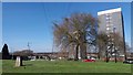
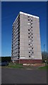
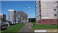
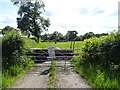
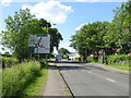
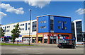
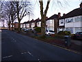
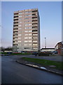
41 photos from this area
Area Information
Key information about the B14 5DP including its size, population, and administrative classification.
- Area Type
- Postcode
- Area Size
- 5608 m²
- Population
- 1364
- Population Density
- 7106 people/km²
House Prices in B14 5DP
17
Properties
£134,885
Average Sold Price
£43,000
Lowest Price
£256,000
Highest Price
Showing 17 properties
| Address | Type | Beds | Baths | Last Sale Price | Last Sale Date | |
|---|---|---|---|---|---|---|
| 90 Henlow Road, Birmingham, B14 5DP | house | 3 | 1 | £256,000 | Nov 2024 | |
| 88 Henlow Road, Birmingham, B14 5DP | house | - | - | £170,000 | May 2023 | |
| 102 Henlow Road, Birmingham, B14 5DP | Retail | 3 | 1 | £240,000 | Dec 2022 | |
| 116 Henlow Road, Birmingham, B14 5DP | Semi-detached | 3 | 1 | £200,000 | Jun 2020 | |
| 84 Henlow Road, Birmingham, B14 5DP | Terraced | 3 | 2 | £165,000 | May 2018 | |
| 82 Henlow Road, Birmingham, B14 5DP | Semi-detached | - | - | £140,000 | Mar 2018 | |
| 108 Henlow Road, Birmingham, B14 5DP | house | 3 | 1 | £115,500 | Jan 2010 | |
| 98 Henlow Road, Birmingham, B14 5DP | Terraced | - | - | £124,000 | Jan 2006 | |
| 100 Henlow Road, Birmingham, B14 5DP | Terraced | - | - | £94,000 | Jul 2003 | |
| 96 Henlow Road, Birmingham, B14 5DP | Terraced | - | - | £100,000 | Aug 2002 |
Page 1 of 2
Energy Efficiency in B14 5DP
Amenities
Schools
| Rank | School | Type | Entry gender | Ages |
|---|
Explore more schools in this area
Go to Schools tabDemographics
Household Size
Family (3-5 people)
most common
Accommodation Type
Houses
most common
Tenure
71
majority
Ethnic Group
White
most common
Religion
N/A
most common
Household Composition
N/A
most common
Age
47
median
Adults (30-64 years)
most common
Household Deprivation
N/A
with no deprivation
NS-SEC
26
in Lower managerial occupations
Explore more demographic insights in this area
Go to Demographics tabPlanning
Planning Constraints
- Flood RiskPremium
- Ramsar Wetland SitesPremium
- Area of Outstanding Natural BeautyPremium
- Protected Nature ReservePremium
- Protected WoodlandPremium