Area Overview for B14 5AF
Photos of B14 5AF
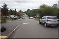
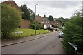
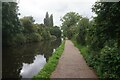
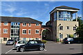
40 photos from this area
Area Information
Key information about the B14 5AF including its size, population, and administrative classification.
- Area Type
- Postcode
- Area Size
- 2.6 hectares
- Population
- 2795
- Population Density
- 4257 people/km²
House Prices in B14 5AF
37
Properties
£163,045
Average Sold Price
£22,000
Lowest Price
£330,000
Highest Price
Showing 37 properties
| Address | Type | Beds | Baths | Last Sale Price | Last Sale Date | |
|---|---|---|---|---|---|---|
| 261 Broad Lane, Birmingham, B14 5AF | Detached | 3 | 1 | £330,000 | May 2025 | |
| 267 Broad Lane, Birmingham, B14 5AF | house | 3 | 1 | £270,000 | Apr 2025 | |
| 287 Broad Lane, Birmingham, B14 5AF | Semi-detached | 2 | 1 | £233,000 | Dec 2024 | |
| 269 Broad Lane, Birmingham, B14 5AF | Semi-detached | 3 | 1 | £275,000 | Jul 2022 | |
| 285 Broad Lane, Birmingham, B14 5AF | house | - | - | £250,000 | Apr 2021 | |
| 293 Broad Lane, Birmingham, B14 5AF | house | - | - | £230,000 | Feb 2020 | |
| 235 Broad Lane, Birmingham, B14 5AF | Semi-detached | 2 | 1 | £195,000 | Jun 2019 | |
| 265 Broad Lane, Birmingham, B14 5AF | house | 3 | 1 | £189,000 | Nov 2018 | |
| 239 Broad Lane, Birmingham, B14 5AF | Semi-detached | 3 | - | £153,500 | Dec 2016 | |
| 237 Broad Lane, Birmingham, B14 5AF | Semi-detached | 3 | - | £152,000 | Oct 2014 |
Page 1 of 4
Energy Efficiency in B14 5AF
Amenities
Schools
| Rank | School | Type | Entry gender | Ages |
|---|
Explore more schools in this area
Go to Schools tabDemographics
Household Size
Family (3-5 people)
most common
Accommodation Type
Houses
most common
Tenure
71
majority
Ethnic Group
White
most common
Religion
N/A
most common
Household Composition
N/A
most common
Age
47
median
Adults (30-64 years)
most common
Household Deprivation
N/A
with no deprivation
NS-SEC
37
in Lower managerial occupations
Explore more demographic insights in this area
Go to Demographics tabPlanning
Planning Constraints
- Flood RiskPremium
- Ramsar Wetland SitesPremium
- Area of Outstanding Natural BeautyPremium
- Protected Nature ReservePremium
- Protected WoodlandPremium