Area Overview for B14 4SQ
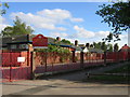
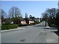
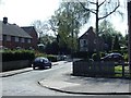
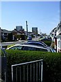
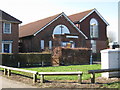
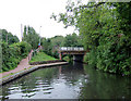
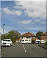
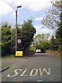
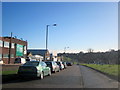
Photos of B14 4SQ


Area Information
B14 4SQ is a small, tightly knit residential area nestled in the outer south of Birmingham, England. With a population of just 1,457, it reflects the character of a suburban district that avoided the industrial squalor of 19th-century Birmingham. The area is part of Highter’s Heath, a ward historically shaped by the 1911 Greater Birmingham Scheme, which expanded the city’s boundaries. Its proximity to Maypole and Yardley Wood gives it a quiet, residential feel, with homes predominantly set in single-family properties. Daily life here is defined by a mix of professional and artisan communities, many of whom have lived in the area for generations. The postcode’s small size means it is closely tied to nearby amenities, from local shops to rail stations. While it lacks the density of central Birmingham, its low population and historical roots make it a distinct, manageable community. For those seeking a balance between urban access and suburban calm, B14 4SQ offers a snapshot of a quieter, more traditional Birmingham suburb.
- Area Type
- Postcode
- Area Size
- Not available
- Population
- 1457
- Population Density
- 2958 people/km²
The property market in B14 4SQ is characterised by a high rate of home ownership (58%) and a predominance of single-family houses. This suggests a market skewed towards owner-occupied homes rather than rental properties, which may appeal to families seeking stability and long-term investment. The presence of houses indicates a focus on private, spacious living, contrasting with the denser housing stock of central Birmingham. Given the area’s small size, the housing stock is limited, but the high ownership rate implies a competitive market for buyers. For those considering the area, the availability of houses may be a key draw, though the small postcode size means the immediate surroundings are critical for finding additional options. The mix of professional and artisan residents further supports a market that values established, well-maintained properties.
House Prices in B14 4SQ
No properties found in this postcode.
Energy Efficiency in B14 4SQ
The lifestyle in B14 4SQ is shaped by its proximity to a range of practical amenities. Nearby retail options include Lidl Warstock, Spar Millpool, and Heron Yardley, offering everyday shopping needs. The area’s rail and metro connections—such as Yardley Wood Station and Edgbaston Village—provide access to Birmingham’s transport network, facilitating travel to work, leisure, or social events. While the data does not list parks or leisure facilities explicitly, the area’s historical character as a “healthy spot” suggests a focus on livability. The presence of Immanuel Church and Hollywood Primary School adds to the community feel, offering both spiritual and educational anchors. Overall, the mix of retail, transport, and local institutions creates a convenient, if modest, lifestyle that balances suburban tranquillity with urban accessibility.
Amenities
Schools
The nearest school to B14 4SQ is Grendon Primary School, which has an Ofsted rating of “good.” This indicates a reliable educational option for younger children, though no secondary schools are listed in the data. The presence of a primary school with a strong rating is a significant factor for families prioritising local education. However, parents seeking secondary schooling may need to look further afield, as the area does not include higher-level institutions. The mix of school types is limited to primary education, which may influence decisions about proximity to other educational facilities. For families, the quality of Grendon Primary School offers reassurance about the immediate availability of a well-regarded school, though additional research into secondary options would be necessary.
| Rank | School | Type | Entry gender | Ages |
|---|
Explore more schools in this area
Go to Schools tabDemographics
The population of B14 4SQ is 1,457, with a median age of 47 and the majority of residents falling within the 30–64 age range. This suggests a community of established professionals and families, with a strong presence of middle-aged adults. Home ownership is high at 58%, indicating a stable, long-term resident base. The area is predominantly composed of houses, reflecting a preference for private, family-oriented living. The predominant ethnic group is White, though no specific diversity statistics are provided. The age profile and ownership rates suggest a mature, settled population, likely with a focus on long-term residency. While no deprivation data is available, the high home ownership and age demographics imply a community with relatively stable economic conditions. This aligns with the area’s historical development as a healthy, middle-class suburb.
Household Size
Accommodation Type
Tenure
Ethnic Group
Religion
Household Composition
Age
Household Deprivation
NS-SEC
Explore more demographic insights in this area
Go to Demographics tabPlanning
Planning Constraints
- Flood RiskPremium
- Ramsar Wetland SitesPremium
- Area of Outstanding Natural BeautyPremium
- Protected Nature ReservePremium
- Protected WoodlandPremium