Area Overview for B14 4RT
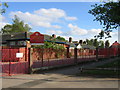
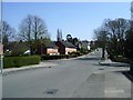
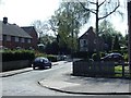
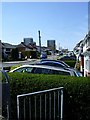
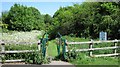
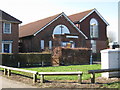
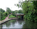
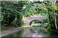
Photos of B14 4RT

Area Information
Living in B14 4RT means inhabiting a compact, densely populated postcode area in England’s West Midlands. This small residential cluster, part of the broader Highter’s Heath district, covers just 2.5 hectares yet hosts 1,457 residents, translating to a staggering 58,041 people per square kilometre. The area’s history dates to the 15th century, with its name first recorded as *Heyters Heath* in 1495. Today, it forms part of Birmingham’s outer south, encompassing Warstock, Maypole, and parts of Yardley Wood. The district avoided the industrial squalor that plagued much of Birmingham, developing as a suburban hub for professionals, artisans, and middle-class families. Its proximity to Maypole and the surrounding green spaces offers a contrast to the city’s urban sprawl, though the area’s small size means every resident shares a tightly knit, high-density community. For those seeking a compact, historically rooted environment with easy access to Birmingham’s infrastructure, B14 4RT presents a unique blend of suburban calm and city connectivity.
- Area Type
- Postcode
- Area Size
- 2.5 hectares
- Population
- 1457
- Population Density
- 2958 people/km²
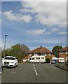
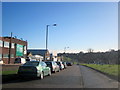
The property market in B14 4RT is characterised by a strong presence of owner-occupied homes, with 58% of residents living in properties they own. The area is predominantly composed of houses, indicating a suburban rather than high-rise or terraced housing stock. Given the postcode’s small size—just 2.5 hectares—and high population density, the housing stock is likely limited in scale, with little scope for new developments. Buyers should consider that the area’s compact nature means properties are closely spaced, and the immediate surroundings may offer similar housing types. For those seeking a family home with a traditional layout, B14 4RT’s mix of houses and established community appeal may be attractive, though the limited land area could restrict options for larger properties.
House Prices in B14 4RT
No properties found in this postcode.
Energy Efficiency in B14 4RT
The lifestyle in B14 4RT is shaped by its proximity to practical amenities. Nearby retail options include Lidl Warstock, Spar Millpool, and Heron Yardley, providing everyday shopping convenience. The area’s rail and metro stations—Yardley Wood, Shirley, and Whitlocks End—offer direct links to Birmingham’s broader network, facilitating access to leisure, employment, and cultural activities. While the data does not specify parks or recreational spaces, the area’s historical development as a healthy suburban zone suggests potential for green spaces. The mix of retail, transport, and suburban character creates a balanced lifestyle, blending local convenience with connectivity to the city’s resources.
Amenities
Schools
The nearest school to B14 4RT is Grendon Primary School, which serves the local community with a good Ofsted rating. As a primary school, it caters to younger children, but families requiring secondary education will need to look beyond the immediate area. The absence of secondary schools within B14 4RT itself means parents should consider proximity to larger educational institutions in nearby parts of Birmingham. However, Grendon Primary’s positive rating suggests a reliable foundation for early education. The single school listed in the data reflects the area’s small size, though its quality provides reassurance for families prioritising primary schooling.
| Rank | School | Type | Entry gender | Ages |
|---|
Explore more schools in this area
Go to Schools tabDemographics
B14 4RT’s population skews towards adults aged 30–64, with a median age of 47. This suggests a community of established professionals and families, many of whom own their homes—58% of households are owner-occupied, compared to 42% renting. The area is predominantly composed of houses, reflecting a traditional suburban layout. The dominant ethnic group is White, though no specific data on diversity or deprivation is provided. The high population density—over 58,000 people per square kilometre—implies a mix of compact living and shared resources, which may influence local amenities and services. While the data does not quantify deprivation, the high home ownership rate and mature age profile suggest a relatively stable, middle-class demographic with established roots in the area.
Household Size
Accommodation Type
Tenure
Ethnic Group
Religion
Household Composition
Age
Household Deprivation
NS-SEC
Explore more demographic insights in this area
Go to Demographics tabPlanning
Planning Constraints
- Flood RiskPremium
- Ramsar Wetland SitesPremium
- Area of Outstanding Natural BeautyPremium
- Protected Nature ReservePremium
- Protected WoodlandPremium