Area Overview for B14 4RR
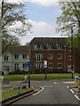
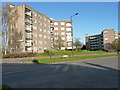
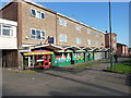
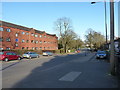
Photos of B14 4RR

Area Information
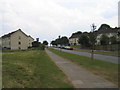
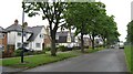
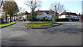
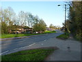
B14 4RR is a small residential postcode area in Birmingham’s Selly Oak district, encompassing parts of Billesley, Moseley, Hall Green, and Yardley Wood. With a population of 1,667, it is a compact, established community characterised by low-density housing and proximity to green spaces such as Billesley Common, Chinn Brook Meadows, and Swanshurst Park. The area’s origins trace back to the early 20th century, with development beginning on former farms in 1921. Today, it balances suburban tranquillity with easy access to Birmingham’s urban amenities. Residents benefit from a mix of local shops, rail links, and proximity to the city’s cultural and commercial hubs. The area’s appeal lies in its blend of historical roots, modern infrastructure, and a community profile skewed toward adults aged 30–64. While the population figure appears inconsistent with broader municipal data, the lived experience here is defined by a stable, owner-occupied demographic and a low-risk environment for both property and daily life.
- Area Type
- Postcode
- Area Size
- Not available
- Population
- Not available
- Population Density
- Not available
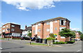
B14 4RR is a predominantly owner-occupied area, with 73% of homes owned by residents rather than rented. The housing stock is largely composed of houses, which contrasts with higher-density urban areas and suggests a suburban, family-friendly character. This configuration may appeal to buyers seeking larger properties with private outdoor space, though the small postcode area means the housing market is limited in scale. The high home ownership rate indicates a stable, long-term resident base, which can reduce turnover and maintain property values. For buyers, this means competition may be lower than in more sought-after urban zones, but the pool of available homes is also smaller. Proximity to rail and metro stations, combined with the area’s low crime risk, adds to its desirability for those prioritising safety and connectivity. However, the limited size of B14 4RR means buyers should consider adjacent postcodes for broader options.
House Prices in B14 4RR
No properties found in this postcode.
Energy Efficiency in B14 4RR
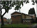
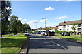
Living in B14 4RR offers access to a range of local amenities within walking or short driving distance. Retail options include Lidl Warstock, Spar Millpool, and Heron Yardley, providing essentials and convenience for daily shopping. The area’s proximity to rail stations such as Yardley Wood and Shirley, as well as metro stops like Edgbaston Village, ensures easy access to Birmingham’s broader retail, dining, and entertainment districts. Nearby green spaces like Billesley Common and Swanshurst Park offer recreational opportunities, while the historical Billesley Manor adds cultural depth. The mix of local shops, transport links, and open spaces creates a balanced lifestyle, blending suburban comfort with urban accessibility. Residents can enjoy a self-contained yet connected existence, with the area’s amenities supporting both routine needs and leisure activities.
Amenities
Schools
| Rank | School | Type | Entry gender | Ages |
|---|
Explore more schools in this area
Go to Schools tabDemographics
The population of B14 4RR is predominantly adults aged 30–64, with a median age of 47. This suggests a mature, settled community, likely with established careers and family structures. Home ownership is high at 73%, indicating a strong presence of long-term residents and a stable property market. The area is primarily composed of houses, reflecting a suburban rather than high-density housing model. The predominant ethnic group is White, though specific diversity metrics are not provided. The age profile and home ownership rate suggest a low proportion of young professionals or students, with a focus on middle-aged households. This demographic aligns with a lifestyle prioritising stability over transient living, which may influence local amenities and services. The absence of detailed deprivation data means the quality of life here cannot be fully contextualised, but the low crime score and lack of environmental constraints imply a generally secure and manageable living environment.
Household Size
Accommodation Type
Tenure
Ethnic Group
Religion
Household Composition
Age
Household Deprivation
NS-SEC
Explore more demographic insights in this area
Go to Demographics tabPlanning
Planning Constraints
- Flood RiskPremium
- Ramsar Wetland SitesPremium
- Area of Outstanding Natural BeautyPremium
- Protected Nature ReservePremium
- Protected WoodlandPremium