Area Overview for B14 4RJ
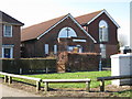
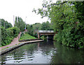
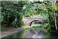
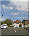
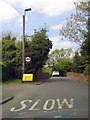
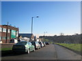
Photos of B14 4RJ


Area Information
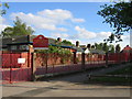
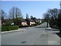
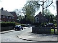
B14 4RJ lies in the southern outskirts of Birmingham, within the Highter’s Heath district, a historically developed suburban area. With a population of 1,457, it is a small, tightly knit postcode covering a cluster of residential properties. The area’s name, often spelled Highters Heath, reflects its long-standing identity, though it is less commonly used in modern signage. Situated east of the Maypole and bordering Warstock, this area was formalised as a ward in 2018, encompassing parts of Yardley Wood and Maypole. Daily life here is shaped by its proximity to Birmingham’s core, offering a quieter suburban feel compared to the city’s industrial past. The community is defined by its mix of business, professional, and artisan backgrounds, a legacy of 19th-century expansion that avoided the worst of urban deprivation. Residents benefit from nearby amenities, including retail, rail links, and schools, while the area’s low flood risk and absence of protected natural sites make it practical for families seeking stability.
- Area Type
- Postcode
- Area Size
- Not available
- Population
- 1457
- Population Density
- 2958 people/km²
B14 4RJ is primarily an owner-occupied area, with 58% of properties in private hands. The housing stock is dominated by houses, which is unusual in modern Birmingham’s more densely populated zones. This suggests a focus on family homes and suburban living, catering to those seeking space and privacy. The relatively small population of 1,457 means the area is not a large market, but its proximity to rail and metro links may attract commuters. For buyers, the predominance of houses implies limited availability of flats or apartments, which could be a consideration for those with different housing needs. The low flood risk and lack of planning constraints make the area appealing for long-term investment, though the high crime risk may influence property values and desirability.
House Prices in B14 4RJ
Showing 4 properties
| Address | Type | Beds | Baths | Last Sale Price | Last Sale Date | |
|---|---|---|---|---|---|---|
| Plot 5, 8 Grange Road, Moseley And Kings Heath, Birmingham, B14 4RJ | Flat | - | - | - | - | |
| Flat 1, 8 Grange Road, Moseley And Kings Heath, Birmingham, B14 4RJ | Flat | - | - | - | - | |
| Flat 2, 8 Grange Road, Moseley And Kings Heath, Birmingham, B14 4RJ | Flat | - | - | - | - | |
| Flat 4, 8 Grange Road, Moseley And Kings Heath, Birmingham, B14 4RJ | Flat | - | - | - | - |
Energy Efficiency in B14 4RJ
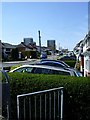
B14 4RJ offers a range of amenities within easy reach, including retail stores like Lidl Warstock, Spar Millpool, and Iceland Maypole, which cater to daily shopping needs. The area’s proximity to rail and metro stations, such as Bournville and Shirley, ensures convenient access to Birmingham’s broader network. While specific parks or leisure facilities are not listed, the absence of protected natural sites suggests open spaces may be limited. The local church, Immanuel, and Hollywood Primary School contribute to the area’s community character. For residents, the mix of retail, transport, and educational facilities creates a practical, self-contained environment, though those seeking extensive leisure options may need to travel further. The convenience of nearby amenities supports a lifestyle that prioritises accessibility over sprawling green spaces.
Amenities
Schools
The nearest school to B14 4RJ is Grendon Primary School, which has an Ofsted rating of ‘good’. This indicates a reliable foundation for early education, though the area lacks secondary schools or further education institutions. Families may need to look beyond the immediate postcode for secondary schooling, which could impact convenience. The presence of a primary school with a good rating suggests that the area is suitable for young children, but the absence of higher education facilities means parents must factor in travel time for older students. The school’s performance is a key consideration for families prioritising quality education, though the limited range of school types may require additional planning for long-term educational needs.
| Rank | School | Type | Entry gender | Ages |
|---|
Explore more schools in this area
Go to Schools tabDemographics
The population of B14 4RJ is predominantly adults aged 30–64, with a median age of 47. This suggests a mature, established community, likely with long-term residents and families. Home ownership here is robust, with 58% of properties owner-occupied, indicating a stable housing market. The area is characterised by houses rather than flats, reflecting a preference for single-family dwellings. The predominant ethnic group is White, though specific diversity metrics are not provided. The age profile suggests a mix of working professionals and retirees, with fewer young families compared to other areas. This demographic structure may influence local services, such as schools and healthcare, which are tailored to adult needs rather than early childhood education. The absence of detailed deprivation data means quality of life is inferred from the area’s infrastructure and safety assessments, which include a critical crime risk.
Household Size
Accommodation Type
Tenure
Ethnic Group
Religion
Household Composition
Age
Household Deprivation
NS-SEC
Explore more demographic insights in this area
Go to Demographics tabPlanning
Planning Constraints
- Flood RiskPremium
- Ramsar Wetland SitesPremium
- Area of Outstanding Natural BeautyPremium
- Protected Nature ReservePremium
- Protected WoodlandPremium