Area Overview for B14 4RF
Photos of B14 4RF
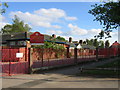
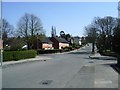
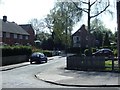
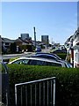
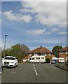
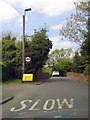
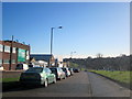

73 photos from this area
Area Information
Key information about the B14 4RF including its size, population, and administrative classification.
- Area Type
- Postcode
- Area Size
- 3805 m²
- Population
- 1457
- Population Density
- 2958 people/km²
House Prices in B14 4RF
22
Properties
£147,558
Average Sold Price
£41,250
Lowest Price
£245,500
Highest Price
Showing 22 properties
| Address | Type | Beds | Baths | Last Sale Price | Last Sale Date | |
|---|---|---|---|---|---|---|
| 59 Moundsley Grove, Birmingham, B14 4RF | Terraced | 3 | 2 | £245,500 | Jun 2025 | |
| 101 Moundsley Grove, Birmingham, B14 4RF | Terraced | 3 | 1 | £240,000 | May 2023 | |
| 93 Moundsley Grove, Birmingham, B14 4RF | Flat | - | - | £70,000 | Feb 2022 | |
| 61 Moundsley Grove, Birmingham, B14 4RF | Semi-detached | 3 | 2 | £211,000 | May 2021 | |
| 97 Moundsley Grove, Birmingham, B14 4RF | Semi-detached | 3 | - | £178,500 | Nov 2018 | |
| 95 Moundsley Grove, Birmingham, B14 4RF | house | 3 | - | £161,000 | Feb 2018 | |
| 103 Moundsley Grove, Birmingham, B14 4RF | Semi-detached | 3 | 2 | £156,000 | May 2017 | |
| 63 Moundsley Grove, Birmingham, B14 4RF | Semi-detached | 3 | - | £170,000 | Oct 2016 | |
| 105 Moundsley Grove, Birmingham, B14 4RF | Terraced | 3 | - | £140,000 | Mar 2016 | |
| 87 Moundsley Grove, Birmingham, B14 4RF | Flat | - | - | £105,000 | Jan 2016 |
Page 1 of 3
Energy Efficiency in B14 4RF
Amenities
Schools
| Rank | School | Type | Entry gender | Ages |
|---|
Explore more schools in this area
Go to Schools tabDemographics
Household Size
Family (3-5 people)
most common
Accommodation Type
Houses
most common
Tenure
58
majority
Ethnic Group
White
most common
Religion
N/A
most common
Household Composition
N/A
most common
Age
47
median
Adults (30-64 years)
most common
Household Deprivation
N/A
with no deprivation
NS-SEC
20
in Lower managerial occupations
Explore more demographic insights in this area
Go to Demographics tabPlanning
Planning Constraints
- Flood RiskPremium
- Ramsar Wetland SitesPremium
- Area of Outstanding Natural BeautyPremium
- Protected Nature ReservePremium
- Protected WoodlandPremium