Area Overview for B14 4PU
Photos of B14 4PU
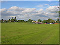
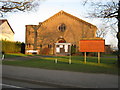
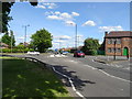

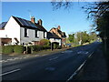
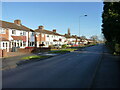

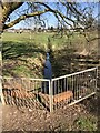
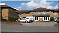


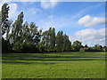
16 photos from this area
Area Information
Key information about the B14 4PU including its size, population, and administrative classification.
- Area Type
- Postcode
- Area Size
- 3344 m²
- Population
- 1542
- Population Density
- 4697 people/km²
House Prices in B14 4PU
9
Properties
£131,750
Average Sold Price
£51,500
Lowest Price
£232,000
Highest Price
Showing 9 properties
| Address | Type | Beds | Baths | Last Sale Price | Last Sale Date | |
|---|---|---|---|---|---|---|
| 222 Maypole Lane, Birmingham, B14 4PU | house | - | - | £215,000 | Apr 2021 | |
| 228 Maypole Lane, Birmingham, B14 4PU | house | 3 | 1 | £232,000 | Jul 2019 | |
| 236 Maypole Lane, Birmingham, B14 4PU | house | - | - | £132,500 | Feb 2003 | |
| 226 Maypole Lane, Birmingham, B14 4PU | Terraced | - | - | £103,000 | Jun 2002 | |
| 232 Maypole Lane, Birmingham, B14 4PU | Terraced | - | - | £56,500 | Feb 1997 | |
| 224 Maypole Lane, Birmingham, B14 4PU | Terraced | - | - | £51,500 | Jul 1996 | |
| 234 Maypole Lane, Birmingham, B14 4PU | house | 3 | 1 | - | - | |
| 220 Maypole Lane, Birmingham, B14 4PU | house | 3 | - | - | - | |
| 230 Maypole Lane, Birmingham, B14 4PU | Terraced | - | - | - | - |
Energy Efficiency in B14 4PU
Amenities
Schools
| Rank | School | Type | Entry gender | Ages |
|---|
Explore more schools in this area
Go to Schools tabDemographics
Household Size
One person
most common
Accommodation Type
Houses
most common
Tenure
59
majority
Ethnic Group
White
most common
Religion
N/A
most common
Household Composition
N/A
most common
Age
47
median
Adults (30-64 years)
most common
Household Deprivation
N/A
with no deprivation
NS-SEC
20
in Lower managerial occupations
Explore more demographic insights in this area
Go to Demographics tabPlanning
Planning Constraints
- Flood RiskPremium
- Ramsar Wetland SitesPremium
- Area of Outstanding Natural BeautyPremium
- Protected Nature ReservePremium
- Protected WoodlandPremium