Area Overview for B14 4PT
Photos of B14 4PT


Area Information
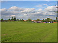
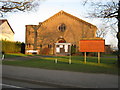
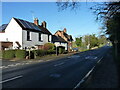
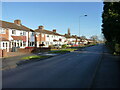
Living in B14 4PT, a small residential cluster in the southern outskirts of Birmingham, offers a quiet suburban lifestyle with easy access to urban amenities. The area, part of Highter’s Heath, lies east of the Maypole and includes Warstock and parts of Yardley Wood. With a population of 1,189, it is a tightly knit community shaped by late 19th-century suburban expansion. Unlike Birmingham’s industrial core, this area avoided the worst of industrial squalor, becoming a healthier, middle-class enclave. Daily life here balances residential tranquillity with proximity to retail, transport, and cultural hubs. The postcode’s compact size means residents share a strong local identity, with amenities and services clustered closely. Its location near major railway lines and motorways ensures connectivity without the congestion of central Birmingham. For those seeking a blend of suburban comfort and urban accessibility, B14 4PT provides a distinct character rooted in its history as a planned residential district.
- Area Type
- Postcode
- Area Size
- Not available
- Population
- 1189
- Population Density
- 6110 people/km²
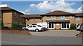
B14 4PT is a largely owner-occupied area, with 92% of properties owned by residents rather than rented. The accommodation type is predominantly houses, which is unusual for modern urban areas but aligns with the postcode’s suburban character. This suggests a housing stock that is older, with fewer high-density developments. The small size of the area means the property market is limited to a handful of homes, likely offering fewer choices for buyers but potentially fostering a close-knit community. The high homeownership rate also implies that properties may be held for the long term, reducing turnover. For buyers, this means a focus on individual homes rather than apartments, with potential for family-oriented living. The proximity to transport links and amenities may enhance the appeal of these properties for those seeking a balance between residential peace and urban convenience.
House Prices in B14 4PT
No properties found in this postcode.
Energy Efficiency in B14 4PT
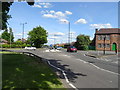
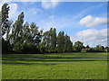
The lifestyle in B14 4PT is supported by a range of nearby amenities, including retail stores such as Sainsburys Maypole, Aldi Warstock, and Asda Solihull New, which provide everyday shopping convenience. The area’s proximity to rail stations like Shirley and Yardley Wood, along with metro stops such as Edgbaston Village, ensures easy access to Birmingham’s cultural and commercial centres. While the data does not mention parks or leisure facilities, the historical context of Highter’s Heath as a healthy, middle-class suburb suggests a focus on quality of life. The mix of retail, transport, and suburban tranquillity creates a practical, accessible lifestyle. Residents can enjoy the benefits of a compact community while remaining within reach of urban opportunities, making it suitable for those who value both convenience and a slower pace of life.
Amenities
Schools
The nearest school to B14 4PT is Hollywood Primary School, a primary school located in the area. While the data lists the same school twice, it is the only educational institution explicitly mentioned. The absence of secondary schools or other educational facilities in the data means families may need to look beyond the immediate postcode for comprehensive schooling. The presence of a primary school suggests that the area is suitable for young children, though parents may need to consider additional transport or commuting arrangements for secondary education. The lack of diversity in school types indicates a focus on early education within the community, but the absence of further details limits a full assessment of the area’s educational offerings.
| Rank | School | Type | Entry gender | Ages |
|---|
Explore more schools in this area
Go to Schools tabDemographics
The population of B14 4PT is 1,189, with a median age of 47 and the majority of residents falling in the 30-64 age range. This suggests a mature, stable community with a strong presence of middle-aged adults. Home ownership is exceptionally high at 92%, indicating a predominantly owner-occupied area with little reliance on rental housing. The accommodation type is primarily houses, reflecting a preference for single-family homes over flats or apartments. The predominant ethnic group is White, though specific diversity metrics are not provided. The age profile and high homeownership rate suggest a community focused on long-term stability, with fewer young families or transient populations. The absence of specific deprivation data means the area’s quality of life is inferred from its low crime rate and access to amenities.
Household Size
Accommodation Type
Tenure
Ethnic Group
Religion
Household Composition
Age
Household Deprivation
NS-SEC
Explore more demographic insights in this area
Go to Demographics tabPlanning
Planning Constraints
- Flood RiskPremium
- Ramsar Wetland SitesPremium
- Area of Outstanding Natural BeautyPremium
- Protected Nature ReservePremium
- Protected WoodlandPremium