Area Overview for B14 4PE
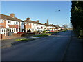
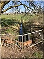
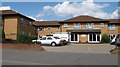
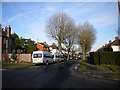
Photos of B14 4PE


Area Information
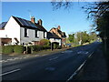
Living in B14 4PE means being part of a small, tightly knit community in the southern outskirts of Birmingham. This postcode, covering a residential cluster in Highter’s Heath, sits just east of the Maypole and includes parts of Warstock and Yardley Wood. With a population of 1,439, the area feels intimate, shaped by its suburban development from the late 19th and early 20th centuries. Unlike much of Birmingham’s industrial past, Highter’s Heath avoided overcrowded housing and poor sanitation, becoming a haven for professionals, artisans, and business owners. The area’s character is defined by its mix of older homes and quiet streets, with easy access to nearby rail links and local amenities. Residents benefit from proximity to Shirley and Whitlocks End railway stations, which connect to central Birmingham and beyond. The postcode’s small size means a strong sense of community, though its limited scale also means fewer large-scale developments or commercial hubs. For those seeking a stable, middle-class environment with a focus on family living, B14 4PE offers a blend of historical charm and modern convenience.
- Area Type
- Postcode
- Area Size
- Not available
- Population
- 1439
- Population Density
- 5535 people/km²
The property market in B14 4PE is dominated by owner-occupied homes, with 81% of properties owned by residents rather than rented. The area’s accommodation type is primarily houses, which is typical of its suburban layout. This suggests a focus on family homes and more spacious living compared to high-density housing. The limited size of the postcode means the market is small, with few new developments, but the existing stock reflects a mix of older properties and well-maintained homes. For buyers, this translates to a stable environment where properties are likely to retain value, though the limited scale of the area may restrict options. The high home ownership rate also indicates a low turnover of properties, which can be both an advantage—reducing competition—and a challenge for those seeking immediate availability. The proximity to rail links and local amenities adds to the appeal, making it a practical choice for those prioritising convenience over large-scale property selection.
House Prices in B14 4PE
No properties found in this postcode.
Energy Efficiency in B14 4PE
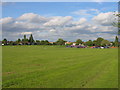
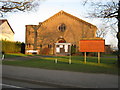
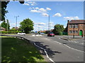
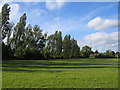
Residents of B14 4PE have access to a range of local amenities within walking or short driving distance. Retail options include Sainsburys Maypole, Aldi Warstock, and Iceland Maypole, providing everyday shopping needs. The area’s proximity to rail stations like Shirley and Whitlocks End ensures easy access to Birmingham’s broader retail and entertainment hubs. For dining, the nearby Maypole and Warstock areas likely offer a mix of local eateries and cafes, though specific venues are not detailed in the data. The historical character of Highter’s Heath, with its tree-lined streets and older homes, contributes to a quieter, more residential vibe compared to busier parts of the city. The local parish church, Immanuel, and Hollywood Primary School are notable landmarks, adding to the area’s community feel. While green spaces are not explicitly mentioned, the area’s legacy as a “healthy spot” during Birmingham’s industrial expansion suggests the presence of parks or open areas. The combination of practical amenities and suburban tranquillity makes daily life in B14 4PE convenient yet unassuming.
Amenities
Schools
| Rank | School | Type | Entry gender | Ages |
|---|
Explore more schools in this area
Go to Schools tabDemographics
The community in B14 4PE is predominantly middle-aged, with a median age of 47 and the majority of residents falling within the 30–64 age range. Home ownership is high, at 81%, indicating a stable population with long-term residency. The area is largely composed of houses rather than flats or apartments, reflecting its suburban character. The predominant ethnic group is White, though specific diversity metrics are not provided. With a population of 1,439, the area is small enough to foster familiarity among neighbours but large enough to support essential services. The age profile suggests a mature demographic, with fewer young families or retirees compared to other parts of Birmingham. This profile aligns with the area’s history as a middle-class suburb, where professionals and artisans have long established roots. The high home ownership rate also implies lower rental activity, making the area less transient than parts of the city with higher student or young professional populations.
Household Size
Accommodation Type
Tenure
Ethnic Group
Religion
Household Composition
Age
Household Deprivation
NS-SEC
Explore more demographic insights in this area
Go to Demographics tabPlanning
Planning Constraints
- Flood RiskPremium
- Ramsar Wetland SitesPremium
- Area of Outstanding Natural BeautyPremium
- Protected Nature ReservePremium
- Protected WoodlandPremium