Area Overview for B14 4NX
Photos of B14 4NX
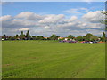

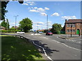

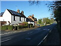
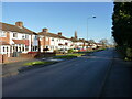


16 photos from this area
Area Information
Key information about the B14 4NX including its size, population, and administrative classification.
- Area Type
- Postcode
- Area Size
- 1.0 hectares
- Population
- 1364
- Population Density
- 7106 people/km²
House Prices in B14 4NX
33
Properties
£151,646
Average Sold Price
£54,050
Lowest Price
£230,000
Highest Price
Showing 33 properties
| Address | Type | Beds | Baths | Last Sale Price | Last Sale Date | |
|---|---|---|---|---|---|---|
| 241 Highters Heath Lane, Birmingham, B14 4NX | Semi-detached | 2 | 1 | £175,000 | Jan 2024 | |
| 285 Highters Heath Lane, Birmingham, B14 4NX | Terraced | 3 | 1 | £230,000 | Aug 2022 | |
| 283 Highters Heath Lane, Birmingham, B14 4NX | house | 3 | 1 | £225,000 | Apr 2022 | |
| 279 Highters Heath Lane, Birmingham, B14 4NX | Terraced | 3 | - | £218,500 | Nov 2021 | |
| 247 Highters Heath Lane, Birmingham, B14 4NX | house | - | - | £170,000 | Apr 2021 | |
| 303 Highters Heath Lane, Birmingham, B14 4NX | Semi-detached | 3 | 1 | £205,000 | Apr 2019 | |
| 297 Highters Heath Lane, Birmingham, B14 4NX | Detached | 3 | 2 | £157,500 | Oct 2016 | |
| 289 Highters Heath Lane, Birmingham, B14 4NX | Semi-detached | 3 | 1 | £138,500 | Nov 2015 | |
| 277 Highters Heath Lane, Birmingham, B14 4NX | Terraced | 3 | - | £125,000 | Jul 2014 | |
| 281 Highters Heath Lane, Birmingham, B14 4NX | house | 3 | - | £95,000 | May 2011 |
Page 1 of 4
Energy Efficiency in B14 4NX
Amenities
Schools
| Rank | School | Type | Entry gender | Ages |
|---|
Explore more schools in this area
Go to Schools tabDemographics
Household Size
Family (3-5 people)
most common
Accommodation Type
Houses
most common
Tenure
71
majority
Ethnic Group
White
most common
Religion
N/A
most common
Household Composition
N/A
most common
Age
47
median
Adults (30-64 years)
most common
Household Deprivation
N/A
with no deprivation
NS-SEC
26
in Lower managerial occupations
Explore more demographic insights in this area
Go to Demographics tabPlanning
Planning Constraints
- Flood RiskPremium
- Ramsar Wetland SitesPremium
- Area of Outstanding Natural BeautyPremium
- Protected Nature ReservePremium
- Protected WoodlandPremium