Area Overview for B14 4LF
Photos of B14 4LF


Area Information
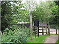
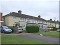
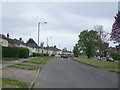
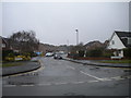
Living in B14 4LF, part of the Highter’s Heath area in Birmingham, offers a quiet suburban existence within the city’s southern boundary. The postcode covers a small residential cluster with a population of 1,542, reflecting its compact nature. Historically, the area developed as a healthy, middle-class suburb during Birmingham’s 19th-century expansion, avoiding the industrial squalor that marked much of the city. Today, it retains a sense of community, with a mix of business, professional, and artisan households. Proximity to Maypole and Warstock adds to its character, while its location near rail and metro lines ensures connectivity without the city’s central congestion. The area’s low flood risk and absence of protected natural sites make it a practical choice for families seeking stability. Despite its small size, B14 4LF balances suburban tranquillity with access to essential services, making it appealing to those prioritising safety and convenience.
- Area Type
- Postcode
- Area Size
- Not available
- Population
- 1542
- Population Density
- 4697 people/km²
The property market in B14 4LF is characterised by a high proportion of owner-occupied homes, with 59% of residents owning their properties. This suggests a stable housing market where long-term residency is common. The area is dominated by houses rather than flats, indicating a focus on family-friendly, single-unit dwellings. Given the postcode’s small size, the housing stock is limited, which may mean properties are in high demand. For buyers, this implies competition for available homes, though the absence of rental data means it is unclear whether the area is more geared towards owner-occupiers or investors. The predominance of houses also suggests that the area may cater to those seeking space and privacy over high-density living.
House Prices in B14 4LF
No properties found in this postcode.
Energy Efficiency in B14 4LF
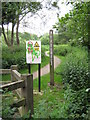
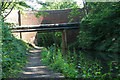
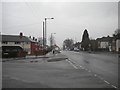
Residents of B14 4LF have access to a range of amenities within practical reach. Retail options include Heron Yardley, Asda Solihull New, and Lidl Warstock, providing everyday shopping convenience. The area’s proximity to rail and metro stations, such as Whitlocks End and Corporation Street, facilitates easy travel to Birmingham’s cultural and commercial hubs. Locally, Immanuel Church and Hollywood Primary School are notable landmarks, contributing to the area’s community identity. While specific parks or leisure facilities are not detailed in the data, the historical reputation of Highter’s Heath as a healthy, suburban spot suggests access to green spaces. The blend of retail, transport, and local institutions creates a balanced lifestyle, supporting both daily needs and broader connectivity.
Amenities
Schools
| Rank | School | Type | Entry gender | Ages |
|---|
Explore more schools in this area
Go to Schools tabDemographics
The population of B14 4LF is predominantly middle-aged, with a median age of 47 and the most common age range being adults aged 30–64. This suggests a community of established professionals and families. Home ownership is high at 59%, indicating a stable, long-term resident base. The area is primarily composed of houses rather than flats, reflecting a preference for traditional family homes. The predominant ethnic group is White, though specific data on diversity is not provided. The absence of detailed deprivation metrics means quality of life is inferred from the area’s safety, infrastructure, and amenities. The demographic profile aligns with a mature, settled population, which may influence local services and social dynamics.
Household Size
Accommodation Type
Tenure
Ethnic Group
Religion
Household Composition
Age
Household Deprivation
NS-SEC
Explore more demographic insights in this area
Go to Demographics tabPlanning
Planning Constraints
- Flood RiskPremium
- Ramsar Wetland SitesPremium
- Area of Outstanding Natural BeautyPremium
- Protected Nature ReservePremium
- Protected WoodlandPremium