Area Overview for B14 4JZ
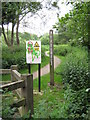
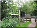
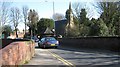
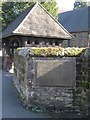
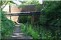
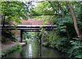
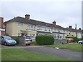
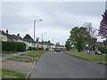
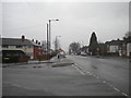
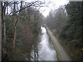
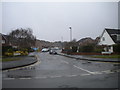
Photos of B14 4JZ

Area Information
Living in B14 4JZ means residing in a small, residential postcode cluster within Highter’s Heath, a district on Birmingham’s southern edge. The area’s population of 1,813 reflects its compact nature, though it is part of a larger ward with a population of over 10,000. Highter’s Heath developed as a suburban area in the late 19th and early 20th centuries, avoiding the industrial squalor that marked much of Birmingham. Today, it retains a mix of business, professional, and artisan residents, shaped by its historical role as a healthier, less industrialised suburb. The area is defined by its proximity to Maypole and its integration with nearby communities like Warstock and Yardley Wood. While not heavily commercialised, it offers a quiet, established residential character with access to nearby transport links and amenities. Its small size means a tight-knit feel, though it remains connected to Birmingham’s broader infrastructure. For buyers, this is a niche area with limited housing stock but a stable, mature community.
- Area Type
- Postcode
- Area Size
- Not available
- Population
- Not available
- Population Density
- Not available
The property market in B14 4JZ is characterised by a high rate of home ownership (64%) and a predominance of houses over other accommodation types. This suggests a suburban, family-oriented market with limited rental activity. The small postcode area likely contains a modest number of properties, making it a niche market for buyers seeking established homes rather than new developments. The focus on owner-occupied housing implies stable values and a community of long-term residents. However, the limited size of the area means buyers may need to look beyond B14 4JZ itself for more options, particularly if seeking specific property types or larger plots. The presence of houses also indicates potential for larger gardens or more private living spaces, appealing to those prioritising space over urban convenience.
House Prices in B14 4JZ
No properties found in this postcode.
Energy Efficiency in B14 4JZ
The lifestyle in B14 4JZ is shaped by its proximity to retail, transport, and suburban amenities. Nearby shops include Heron Yardley, Asda Solihull New, and Lidl Warstock, offering everyday essentials within reach. The area’s rail and metro stations provide easy access to Birmingham’s business districts and cultural hubs. While the data does not mention parks or leisure facilities directly, the historical context of Highter’s Heath as a “healthy spot” suggests potential for green spaces or recreational areas in the surrounding region. The mix of retail and transport options supports a convenient, low-maintenance lifestyle, ideal for those prioritising accessibility over sprawling urban amenities. The area’s character balances suburban tranquillity with practical connectivity.
Amenities
Schools
The nearest school to B14 4JZ is Highters Heath Nursery School, which provides early education services. No primary or secondary schools are listed in the data, meaning families may need to look further afield for comprehensive schooling. The absence of higher-tier educational institutions within the immediate area suggests that parents should consider proximity to larger schools in nearby wards or towns. The presence of a nursery indicates some local provision for young children, but the lack of broader school options may be a consideration for families prioritising a full range of educational facilities. This highlights the need for careful planning when assessing the area’s suitability for households with school-age children.
| Rank | School | Type | Entry gender | Ages |
|---|
Explore more schools in this area
Go to Schools tabDemographics
The population of B14 4JZ has a median age of 47, with the majority of residents aged 30–64. This suggests a community of middle-aged adults, likely in their prime working years. Home ownership stands at 64%, indicating a strong presence of owner-occupied properties. The accommodation type is predominantly houses, reflecting a suburban layout rather than high-density housing. The predominant ethnic group is White, though specific diversity metrics are not provided. This age profile and ownership rate suggest a stable, long-term resident base with fewer young families or transient populations. The absence of data on deprivation or income levels means the area’s quality of life cannot be fully contextualised, but the demographics imply a mature, established community with a focus on private housing.
Household Size
Accommodation Type
Tenure
Ethnic Group
Religion
Household Composition
Age
Household Deprivation
NS-SEC
Explore more demographic insights in this area
Go to Demographics tabPlanning
Planning Constraints
- Flood RiskPremium
- Ramsar Wetland SitesPremium
- Area of Outstanding Natural BeautyPremium
- Protected Nature ReservePremium
- Protected WoodlandPremium