Area Overview for B14 4AE
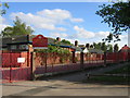
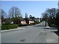
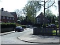
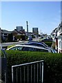
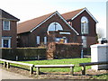
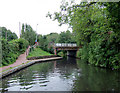
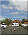
Photos of B14 4AE


Area Information
Living in B14 4AE, part of Highter’s Heath in Birmingham’s outer south, offers a quiet suburban existence with a distinct character. The area, home to 1,613 residents, lies east of the Maypole and includes parts of Warstock and Yardley Wood. Historically, it developed as a healthier alternative to Birmingham’s industrial zones in the late 19th and early 20th centuries, avoiding the squalor of back-to-back housing. Today, it retains a mix of business, professional, and artisanal residents, with Immanuel Church and Hollywood Primary School serving as local landmarks. The district’s low population density and proximity to Maypole Lane and Highters Heath Lane provide a sense of community, though its name is rarely used in signage. For those seeking a settled, low-traffic environment with access to Birmingham’s broader infrastructure, B14 4AE balances suburban calm with urban connectivity.
- Area Type
- Postcode
- Area Size
- Not available
- Population
- 1613
- Population Density
- 6565 people/km²
B14 4AE is a predominantly owner-occupied area, with 62% of homes owned by residents rather than rented. The accommodation type is primarily houses, which is unusual for urban areas but aligns with its suburban character. This suggests a market skewed toward family homes and long-term residents, with limited rental availability. The small population and compact footprint mean the housing stock is likely limited, but the focus on houses may offer more space and privacy compared to apartment-dominated areas. For buyers, this could mean a niche market with fewer properties but potentially higher demand from those seeking stable, low-density living. The lack of high-rise or commercial developments reinforces its residential, family-focused appeal.
House Prices in B14 4AE
No properties found in this postcode.
Energy Efficiency in B14 4AE
B14 4AE’s lifestyle is shaped by its proximity to retail, transport, and green spaces. Local shops like Heron Yardley, Lidl Warstock, and Spar Millpool cater to daily needs, while nearby railway stations and metro stops connect residents to Birmingham’s broader networks. The area’s suburban character, developed to avoid industrial sprawl, offers a quieter alternative to the city’s core. Though specific parks or leisure facilities are not detailed, the historical context suggests a focus on residential comfort over large-scale amenities. The mix of retail, transport, and low-density housing creates a balance between convenience and tranquility, appealing to those prioritising accessibility without urban congestion.
Amenities
Schools
The nearest schools to B14 4AE include Highters Heath Community School, which operates as both a primary and academy. While the same name is used for both institutions, this indicates a range of educational options within the area. The presence of a primary school suggests proximity to family-focused amenities, though specific Ofsted ratings are not provided. The academy designation may imply a broader curriculum or specialist focus, potentially attracting families seeking diverse educational pathways. However, with only one named school listed, the area’s school options appear limited, and prospective residents may need to consider commuting to nearby districts for secondary education.
| Rank | A + A* % | School | Type | Entry gender | Ages |
|---|---|---|---|---|---|
| 1 | N/A | Highters Heath Community School | primary | N/A | N/A |
| 2 | N/A | Highters Heath Community School | academy | N/A | N/A |
Explore more schools in this area
Go to Schools tabDemographics
B14 4AE has a median age of 47, with the majority of residents aged 30–64. This suggests a community of established professionals and families, reflected in the 62% home ownership rate. The area is predominantly composed of houses, indicating a focus on family-oriented living. The predominant ethnic group is White, though specific diversity metrics are not detailed. The population of 1,613 is relatively small, contributing to a close-knit feel. With no data on deprivation levels, the area’s quality of life appears stable, supported by low crime rates and minimal environmental constraints. The age profile and ownership figures suggest a mature, settled community with long-term residency patterns.
Household Size
Accommodation Type
Tenure
Ethnic Group
Religion
Household Composition
Age
Household Deprivation
NS-SEC
Explore more demographic insights in this area
Go to Demographics tabPlanning
Planning Constraints
- Flood RiskLocked
- Ramsar Wetland SitesLocked
- Area of Outstanding Natural BeautyLocked
- Protected Nature ReserveLocked
- Protected WoodlandLocked
- Crime RiskLocked