Area Overview for B13 9XH
Photos of B13 9XH
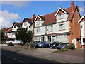
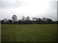
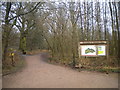
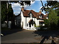
57 photos from this area
Area Information
Key information about the B13 9XH including its size, population, and administrative classification.
- Area Type
- Postcode
- Area Size
- 5946 m²
- Population
- 1819
- Population Density
- 4595 people/km²
House Prices in B13 9XH
10
Properties
£269,000
Average Sold Price
£95,000
Lowest Price
£430,000
Highest Price
Showing 10 properties
| Address | Type | Beds | Baths | Last Sale Price | Last Sale Date | |
|---|---|---|---|---|---|---|
| 255 Wake Green Road, Springfield, Birmingham, B13 9XH | Semi-detached | 4 | 2 | £430,000 | Sep 2024 | |
| 267 Wake Green Road, Springfield, Birmingham, B13 9XH | Detached | 4 | 3 | £420,000 | Dec 2019 | |
| 257 Wake Green Road, Springfield, Birmingham, B13 9XH | Semi-detached | 4 | - | £336,000 | Oct 2019 | |
| 249 Wake Green Road, Springfield, Birmingham, B13 9XH | Detached | 5 | 2 | £350,000 | Aug 2014 | |
| 251 Wake Green Road, Springfield, Birmingham, B13 9XH | house | - | - | £310,000 | Mar 2003 | |
| 261 Wake Green Road, Springfield, Birmingham, B13 9XH | Detached | 4 | 1 | £103,000 | Nov 1999 | |
| 263 Wake Green Road, Springfield, Birmingham, B13 9XH | Semi-detached | - | - | £95,000 | Nov 1999 | |
| 265 Wake Green Road, Springfield, Birmingham, B13 9XH | house | 4 | - | £108,000 | Mar 1999 | |
| 253 Wake Green Road, Springfield, Birmingham, B13 9XH | Detached | 4 | 1 | - | - | |
| 259 Wake Green Road, Springfield, Birmingham, B13 9XH | Detached | 4 | 1 | - | - |
Energy Efficiency in B13 9XH
Amenities
Schools
| Rank | School | Type | Entry gender | Ages |
|---|
Explore more schools in this area
Go to Schools tabDemographics
Household Size
Family (3-5 people)
most common
Accommodation Type
Houses
most common
Tenure
80
majority
Ethnic Group
asian_total
most common
Religion
N/A
most common
Household Composition
N/A
most common
Age
47
median
Adults (30-64 years)
most common
Household Deprivation
N/A
with no deprivation
NS-SEC
35
in Lower managerial occupations
Explore more demographic insights in this area
Go to Demographics tabPlanning
Planning Constraints
- Flood RiskPremium
- Ramsar Wetland SitesPremium
- Area of Outstanding Natural BeautyPremium
- Protected Nature ReservePremium
- Protected WoodlandPremium