Area Overview for B13 9TT
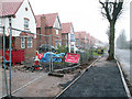
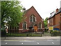
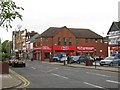
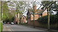
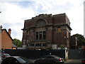
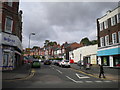
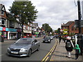
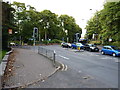
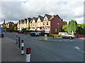
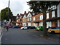
Photos of B13 9TT


Area Information
Living in B13 9TT offers a quiet, suburban experience within Birmingham’s broader urban fabric. With a population of 1,479, this small postcode area is defined by its residential cluster, blending historical character with modern convenience. The median age of 47 suggests a mature community, with adults aged 30–64 forming the largest demographic group. This reflects a settled, family-oriented environment, supported by nearby amenities like Reach School and accessible transport links. The area’s proximity to rail stations such as Bournville and Hall Green ensures easy access to Birmingham’s central districts, while local shops like Asda Kings and Lidl Moseley provide daily essentials. Though small, B13 9TT benefits from low flood risk and a moderate crime score of 55, balancing safety with the need for standard precautions. Its historical roots in King’s Heath and Brandwood add a layer of heritage, with landmarks like the Hare and Hounds pub hinting at the area’s past. For buyers seeking a peaceful, well-connected suburb with a mix of traditional and contemporary living, B13 9TT presents a compelling option.
- Area Type
- Postcode
- Area Size
- Not available
- Population
- 1479
- Population Density
- 5400 people/km²
The property market in B13 9TT is dominated by owner-occupied homes, with 61% of residents owning their properties. This contrasts with a 39% rental market, suggesting a community where long-term residency is more common than short-term tenancies. The accommodation type is primarily houses, which implies a lack of high-density housing such as flats or apartments. This makes the area more suited to families or individuals seeking spacious, standalone homes rather than urban living. Given the small size of the postcode area, the housing stock is likely limited, meaning buyers may need to consider nearby suburbs for more options. The focus on houses also indicates a market where property values may be influenced by factors like garden space, private outdoor areas, and proximity to green spaces. For buyers, this suggests a need to evaluate not only the immediate area but also surrounding neighbourhoods for broader choices.
House Prices in B13 9TT
No properties found in this postcode.
Energy Efficiency in B13 9TT
Residents of B13 9TT have access to a range of nearby amenities, including five retail outlets such as Asda Kings, Iceland Kings, and Lidl Moseley. These shops provide essential groceries and household items, reducing the need for long journeys. The area’s rail and metro connections—via stations like Bournville and Edgbaston Village—offer easy access to Birmingham’s cultural and commercial hubs, including shopping centres and entertainment venues. While the data does not list parks or leisure facilities explicitly, the historical context of the area suggests potential green spaces or heritage sites nearby. The presence of retail and transport options contributes to a convenient, self-contained lifestyle, allowing residents to meet daily needs without leaving the immediate vicinity. This balance of practicality and connectivity enhances the area’s appeal for those prioritising accessibility.
Amenities
Schools
The nearest school to B13 9TT is Reach School, categorised as an ‘other’ type in the data. No Ofsted rating is provided, so its performance cannot be assessed here. The presence of a single named school suggests a limited selection for families, though it may be supplemented by other institutions in nearby areas. The lack of detailed information on school types or ratings means prospective buyers must conduct further research to evaluate educational quality. For families prioritising school options, the area’s proximity to Bournville and Hall Green railway stations could facilitate access to broader educational networks in Birmingham. However, the absence of multiple schools listed in the data highlights the need for additional due diligence when considering B13 9TT as a family-friendly location.
| Rank | School | Type | Entry gender | Ages |
|---|
Explore more schools in this area
Go to Schools tabDemographics
The community in B13 9TT is predominantly composed of adults aged 30–64, with a median age of 47. This suggests a population of settled individuals, likely including families and professionals in their mid-career. Home ownership stands at 61%, indicating a strong presence of owner-occupied properties, which contrasts with the 39% rental market. The area is characterised by houses rather than flats, reflecting a preference for single-family dwellings. The predominant ethnic group is White, though no specific data on diversity beyond this is provided. The age profile implies a community with established routines, potentially supporting local schools and amenities. However, the absence of detailed information on deprivation or income levels means the quality of life can only be partially assessed. The demographic profile aligns with a suburban, low-density environment where stability and long-term residency are common.
Household Size
Accommodation Type
Tenure
Ethnic Group
Religion
Household Composition
Age
Household Deprivation
NS-SEC
Explore more demographic insights in this area
Go to Demographics tabPlanning
Planning Constraints
- Flood RiskPremium
- Ramsar Wetland SitesPremium
- Area of Outstanding Natural BeautyPremium
- Protected Nature ReservePremium
- Protected WoodlandPremium