Area Overview for B13 9RT
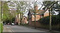
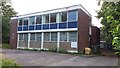
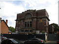
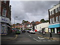
Photos of B13 9RT
Area Information
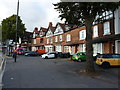
Living in B13 9RT means inhabiting a small, defined residential cluster in the south of Birmingham, a historically significant suburb with a population of 1,479. This area, part of the Moseley ward, reflects a blend of 19th-century suburban development and modern convenience. Its character is shaped by its origins as an independent village before becoming part of Birmingham in 1911. The area is notable for its proximity to Moseley Park and Pool, a local green space, and Cannon Hill Park, created from donated land in 1873. Daily life here is anchored by practical amenities: five retail outlets, including Asda Kings and Iceland Kings, and easy access to rail and metro networks. With a median age of 47 and a predominantly White population, the community is stable, with 61% of homes owner-occupied. The area’s history as a middle-class suburb persists, offering a mix of historic charm and modern infrastructure. Residents benefit from excellent broadband connectivity and proximity to Birmingham New Street Station, making it a practical choice for commuters and families alike.
- Area Type
- Postcode
- Area Size
- Not available
- Population
- 1479
- Population Density
- 5400 people/km²
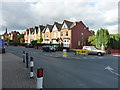
The property market in B13 9RT is characterised by a high rate of home ownership (61%) and a predominance of houses rather than flats or apartments. This suggests a suburban, family-friendly environment where properties are likely to be larger and more traditional in design. The area’s small size means the housing stock is concentrated, with limited scope for new developments. For buyers, this implies a market where demand for owner-occupied homes may outstrip supply, potentially leading to competitive pricing. The lack of rental data means it is unclear whether the area is primarily owner-occupied or if there is a significant rental component. However, the presence of established housing and a mature demographic suggests that properties here are likely to be long-term investments. Buyers should consider the limited geographical scope of the area, as its immediate surroundings may offer similar housing stock, requiring careful evaluation of individual property conditions and location within the postcode.
House Prices in B13 9RT
No properties found in this postcode.
Energy Efficiency in B13 9RT
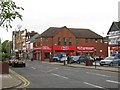
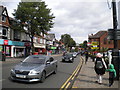
Residents of B13 9RT have access to a range of amenities within practical reach. Retail options include Asda Kings, Iceland Kings, and M&S Moseley, providing everyday shopping convenience. The area’s transport links to Birmingham New Street Station and nearby metro stops make it easy to access the city’s cultural and commercial centres. Locally, Moseley Park and Pool and Cannon Hill Park offer green spaces for recreation, while historical sites like Spring Hill College add cultural depth. The presence of rail and metro stations ensures connectivity to broader networks, supporting both social and professional activities. The mix of retail, transport, and green spaces contributes to a balanced lifestyle, blending suburban tranquillity with urban accessibility. For families, the proximity to parks and historical landmarks provides opportunities for both leisure and education.
Amenities
Schools
The nearest school to B13 9RT is Reach School, which is categorised as an ‘other’ type in the data. No specific Ofsted rating is provided, so its academic performance or facilities cannot be assessed here. The absence of additional schools in the data means that families relying on local education must consider the broader Birmingham school network. While Reach School is the only named institution, the area’s proximity to Moseley’s historical and cultural assets—such as Cannon Hill Park and Spring Hill College—may offer supplementary educational or recreational opportunities. For families, the mix of school types is limited, but the area’s transport links to Birmingham New Street Station and nearby metro stops could provide access to a wider range of educational institutions. Parents may need to look beyond the immediate postcode for a diverse selection of schools.
| Rank | School | Type | Entry gender | Ages |
|---|
Explore more schools in this area
Go to Schools tabDemographics
The demographic profile of B13 9RT is defined by a median age of 47, with the majority of residents falling into the 30–64 age range. This suggests a mature, established community, likely with a strong presence of families and professionals. Home ownership is high at 61%, indicating a stable housing market where most residents live in their own homes. The predominant accommodation type is houses, reflecting a suburban rather than urban layout. The predominant ethnic group is White, which aligns with broader trends in the area. While specific data on deprivation or diversity is not provided, the absence of protected natural areas or high-risk environmental factors suggests a relatively low-stress living environment. The age profile implies a community with a balance of working-age individuals and retirees, potentially supporting local services and amenities. This demographic structure may influence the area’s social dynamics, with a focus on family-oriented living and long-term residency.
Household Size
Accommodation Type
Tenure
Ethnic Group
Religion
Household Composition
Age
Household Deprivation
NS-SEC
Explore more demographic insights in this area
Go to Demographics tabPlanning
Planning Constraints
- Flood RiskPremium
- Ramsar Wetland SitesPremium
- Area of Outstanding Natural BeautyPremium
- Protected Nature ReservePremium
- Protected WoodlandPremium