Area Overview for B13 8WR
Photos of B13 8WR


Area Information
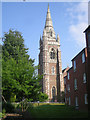
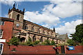
Living in B13 8WR means being part of a small, tightly knit residential cluster in the heart of Moseley, a suburban ward in south Birmingham. With a population of 1,659, the area retains a village-like character despite its proximity to the city. Historically, Moseley was an independent village before becoming part of Birmingham in 1911, and its heritage is evident in landmarks like the Moseley Tunnel, believed to be the first railway tunnel in Birmingham. The area’s layout reflects 19th-century development, with piecemeal housing that evolved as Birmingham’s industry grew. Today, B13 8WR offers a mix of convenience and tranquillity, with easy access to transport networks and green spaces. Residents benefit from proximity to Cannon Hill Park, a public space gifted in 1873, and Moseley Park and Pool, a local gem. The area’s compact size means a strong sense of community, with amenities like Co-op Moseley and railway stations within practical reach. For those seeking a balance between suburban calm and urban accessibility, B13 8WR provides a distinctive blend.
- Area Type
- Postcode
- Area Size
- Not available
- Population
- 1659
- Population Density
- 2286 people/km²
The property market in B13 8WR is characterised by a high rate of home ownership (77%), with houses forming the predominant accommodation type. This suggests a residential area focused on owner-occupation rather than rental properties, which may appeal to buyers seeking stability and long-term investment. The compact nature of the postcode area means the housing stock is likely limited in scale, with homes concentrated in a small cluster. Given the high home ownership rate, the market may be less influenced by short-term rental trends, offering buyers a sense of permanence. The presence of houses rather than flats indicates a preference for family homes, which aligns with the area’s demographic profile of adults aged 30–64. For buyers, this suggests a market where properties are likely to be in good condition, with potential for community engagement in a close-knit environment. However, the small size of the area means competition for available homes may be keen.
House Prices in B13 8WR
No properties found in this postcode.
Energy Efficiency in B13 8WR
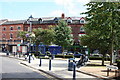
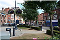
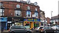
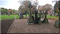
Residents of B13 8WR have access to a range of amenities within practical reach. Nearby retail options include Co-op Moseley, M&S Moseley, and Lidl Sparkbrook, providing everyday shopping needs. The area’s transport links also serve as a gateway to broader leisure opportunities, with stations like Selly Oak Railway Station offering access to cultural and recreational hubs in Birmingham. Green spaces such as Moseley Park and Pool and Cannon Hill Park, created from donated land in 1873, offer recreational space for walking, picnics, or relaxation. The presence of these parks, combined with the area’s historical landmarks like Spring Hill College, adds to the local character. The mix of retail, transport, and open spaces creates a lifestyle that balances convenience with a sense of community, making daily life in B13 8WR both practical and pleasant.
Amenities
Schools
The nearest school to B13 8WR is Red Boots School (National Institute of Conductive Education), a special school with an outstanding Ofsted rating. This institution caters to students with specific educational needs, offering a tailored approach to learning. The presence of a special school in the area is significant for families with children requiring specialist support, as it eliminates the need to travel far for appropriate education. While no other schools are listed in the data, the existence of Red Boots School highlights the area’s commitment to inclusive education. For families prioritising accessible, high-quality schooling, this is a key advantage. The school’s outstanding rating reflects its effectiveness in meeting the needs of its students, which can be a decisive factor for homebuyers considering the area’s suitability for raising children.
| Rank | School | Type | Entry gender | Ages |
|---|
Explore more schools in this area
Go to Schools tabDemographics
The community in B13 8WR is predominantly middle-aged, with a median age of 47 and the most common age range being adults aged 30–64. This suggests a stable, family-oriented population. Home ownership is high at 77%, indicating a strong presence of long-term residents. The accommodation type is primarily houses, reflecting a residential area with fewer flats or apartments. The predominant ethnic group is Asian, which shapes the cultural fabric of the neighbourhood. While specific deprivation data is not provided, the high home ownership rate and low crime risk (71/100) suggest a relatively affluent and secure environment. The age profile implies a mix of working professionals and families, with fewer young children or retirees compared to other areas. This demographic structure may influence local services and amenities, aligning with the needs of adults in their prime working and family-raising years.
Household Size
Accommodation Type
Tenure
Ethnic Group
Religion
Household Composition
Age
Household Deprivation
NS-SEC
Explore more demographic insights in this area
Go to Demographics tabPlanning
Planning Constraints
- Flood RiskPremium
- Ramsar Wetland SitesPremium
- Area of Outstanding Natural BeautyPremium
- Protected Nature ReservePremium
- Protected WoodlandPremium