Area Overview for B13 8WP
Photos of B13 8WP


Area Information
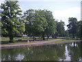
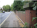
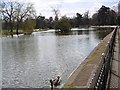
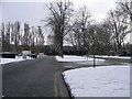
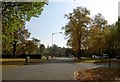
Living in B13 8WP means being part of a tightly knit residential cluster in Birmingham’s Moseley area, a historic suburb with roots tracing back to the 18th century. The postcode covers just 1,659 residents, reflecting its small, community-focused character. Moseley itself has evolved from an independent village into a middle-class suburb, shaped by 19th-century industrial expansion and the arrival of the Birmingham and Gloucester Railway. Today, the area balances suburban tranquillity with proximity to Birmingham’s urban centres. Its compact size means amenities and services are within practical reach, from local shops to transport hubs. The demographic profile suggests a mature population, with adults aged 30–64 forming the majority. This is a place where heritage meets modern convenience, with landmarks like Moseley Park and Cannon Hill Park offering green spaces amid the residential fabric. For buyers, B13 8WP represents a chance to live in a historically rich area with low crime rates and strong digital connectivity, all within a walkable, family-friendly setting.
- Area Type
- Postcode
- Area Size
- Not available
- Population
- 1659
- Population Density
- 2286 people/km²
B13 8WP is predominantly a home-ownership area, with 77% of properties owned by residents rather than rented. The accommodation type is largely houses, which is typical for a suburban postcode in Birmingham. This suggests a market skewed towards owner-occupied homes, with fewer rental properties available. The compact size of the area means the housing stock is concentrated within a small geographical footprint, potentially limiting availability for buyers. However, the high home ownership rate indicates strong local demand and stability. For buyers, this means competition may be fierce, but the presence of houses rather than apartments or flats could appeal to those seeking space and privacy. The area’s low crime risk and proximity to amenities like parks and transport further enhance its desirability, though the small size of the postcode means properties are likely to be in close proximity to one another.
House Prices in B13 8WP
No properties found in this postcode.
Energy Efficiency in B13 8WP
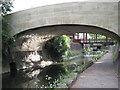
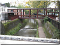
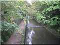
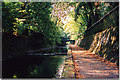
Residents of B13 8WP have access to a range of amenities within practical reach. Local retail options include Aldi Edgbaston, Asda Edgbaston, and Co-op Moseley, providing everyday shopping convenience. The area’s transport links connect to multiple railway stations and metro stops, facilitating easy travel to Birmingham’s business and cultural hubs. Green spaces like Moseley Park and Cannon Hill Park offer recreational opportunities, while historical sites such as Moseley Tunnel and Spring Hill College add to the area’s character. The presence of a special school with an outstanding rating ensures families have access to high-quality education. Overall, the lifestyle in B13 8WP balances suburban comfort with urban accessibility, offering a mix of heritage, greenery, and modern convenience that appeals to a variety of residents.
Amenities
Schools
The most notable school near B13 8WP is Red Boots School, a special school with an outstanding Ofsted rating. This institution caters to students with specific educational needs, offering a high standard of care and teaching. While no other schools are listed in the data, the presence of this school suggests the area is well-served for families requiring specialist education. The absence of mainstream primary or secondary schools in the immediate vicinity may mean parents need to look slightly beyond the postcode for broader educational options. However, the outstanding rating at Red Boots School indicates a strong commitment to inclusivity and quality in education. For families with children requiring special needs support, this school is a significant advantage, though those prioritising a wider range of schools may need to consider nearby areas.
| Rank | School | Type | Entry gender | Ages |
|---|---|---|---|---|
| 1 | Red Boots School (National Institute of Conductive Education) | special | N/A | N/A |
Explore more schools in this area
Go to Schools tabDemographics
The population of B13 8WP is 1,659, with a median age of 47, indicating a mature, settled community. The majority of residents are adults aged 30–64, suggesting a mix of established families and professionals. Home ownership is high at 77%, reflecting a stable housing market where most properties are owner-occupied. The predominant accommodation type is houses, aligning with the area’s suburban character. The largest ethnic group is the Asian community, which contributes to the area’s cultural diversity. While specific deprivation data is not provided, the high home ownership and low crime score of 71/100 imply a relatively affluent and secure environment. This demographic profile suggests a community prioritising stability, with residents likely to have long-term ties to the area. The presence of a special school with an outstanding Ofsted rating further underscores the area’s appeal to families seeking quality education.
Household Size
Accommodation Type
Tenure
Ethnic Group
Religion
Household Composition
Age
Household Deprivation
NS-SEC
Explore more demographic insights in this area
Go to Demographics tabPlanning
Planning Constraints
- Flood RiskPremium
- Ramsar Wetland SitesPremium
- Area of Outstanding Natural BeautyPremium
- Protected Nature ReservePremium
- Protected WoodlandPremium
- Crime RiskPremium