Area Overview for B13 8RA
Photos of B13 8RA
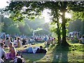

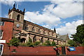
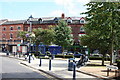
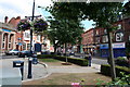

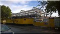
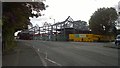
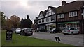
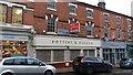
100 photos from this area
Area Information
Key information about the B13 8RA including its size, population, and administrative classification.
- Area Type
- Postcode
- Area Size
- 9919 m²
- Population
- 1659
- Population Density
- 2286 people/km²
House Prices in B13 8RA
9
Properties
£454,929
Average Sold Price
£99,500
Lowest Price
£775,000
Highest Price
Showing 9 properties
| Address | Type | Beds | Baths | Last Sale Price | Last Sale Date | |
|---|---|---|---|---|---|---|
| 1A Russell Road, Moseley And Kings Heath, Birmingham, B13 8RA | Detached | 4 | - | £505,000 | May 2022 | |
| 13 Russell Road, Moseley And Kings Heath, Birmingham, B13 8RA | house | - | - | £775,000 | Jun 2021 | |
| 3 Russell Road, Moseley And Kings Heath, Birmingham, B13 8RA | Semi-detached | 3 | 1 | £380,000 | Nov 2017 | |
| 1C Russell Road, Moseley And Kings Heath, Birmingham, B13 8RA | Detached | 4 | 1 | £450,000 | Oct 2017 | |
| 1 Russell Road, Moseley And Kings Heath, Birmingham, B13 8RA | Semi-detached | 3 | 2 | £550,000 | Apr 2017 | |
| 15 Russell Road, Moseley And Kings Heath, Birmingham, B13 8RA | Detached | - | - | £425,000 | Feb 2010 | |
| 1B Russell Road, Moseley And Kings Heath, Birmingham, B13 8RA | Detached | - | - | £99,500 | Dec 1995 | |
| 11 Russell Road, Moseley And Kings Heath, Birmingham, B13 8RA | Semi-detached | 4 | 1 | - | - | |
| 9 Russell Road, Moseley And Kings Heath, Birmingham, B13 8RA | Semi-detached | - | - | - | - |
Energy Efficiency in B13 8RA
Amenities
Schools
| Rank | School | Type | Entry gender | Ages |
|---|
Explore more schools in this area
Go to Schools tabDemographics
Household Size
Family (3-5 people)
most common
Accommodation Type
Houses
most common
Tenure
77
majority
Ethnic Group
asian_total
most common
Religion
N/A
most common
Household Composition
N/A
most common
Age
47
median
Adults (30-64 years)
most common
Household Deprivation
N/A
with no deprivation
NS-SEC
54
in Lower managerial occupations
Explore more demographic insights in this area
Go to Demographics tabPlanning
Planning Constraints
- Flood RiskPremium
- Ramsar Wetland SitesPremium
- Area of Outstanding Natural BeautyPremium
- Protected Nature ReservePremium
- Protected WoodlandPremium