Area Overview for B13 8QQ
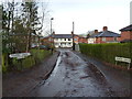
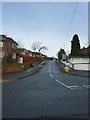
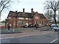
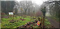
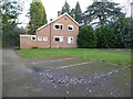
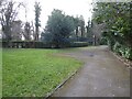
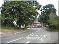
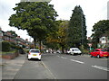
Photos of B13 8QQ
Area Information
Living in B13 8QQ means being part of a small, densely populated residential cluster in south Birmingham, England. The area’s population of 1,785 is spread across 1.26 km², creating a compact community with a high population density of 1,402 people per square kilometre. Historically, B13 8QQ—part of Moseley—was an independent village before becoming part of Birmingham in 1911. Today, it retains a suburban character shaped by 19th-century development, with piecemeal housing and a focus on middle-class living. The area is served by multiple primary schools, including Moor Green Primary Academy, which holds an outstanding Ofsted rating. Residents benefit from proximity to rail networks, including Selly Oak and Bournville stations, and a mix of retail amenities like Asda and Lidl. Daily life here balances suburban tranquillity with urban accessibility, offering a blend of historical heritage and modern convenience.
- Area Type
- Postcode
- Area Size
- Not available
- Population
- 1785
- Population Density
- 1402 people/km²
The property market in B13 8QQ is dominated by owner-occupied homes, with 59% of properties owned by residents. The accommodation type is primarily houses, reflecting a suburban layout typical of post-19th-century development in Moseley. This suggests a focus on family homes rather than high-density housing or rental units. Given the area’s small size and high population density, the housing stock is likely limited, with properties concentrated in a compact cluster. Buyers should expect a mix of older and more recently built homes, shaped by Moseley’s historical evolution from a village to a suburb. The predominance of houses may appeal to families seeking space, though the small area means competition for available properties could be strong. Prospective buyers should also consider the proximity to schools and transport links as key selling points.
House Prices in B13 8QQ
No properties found in this postcode.
Energy Efficiency in B13 8QQ
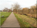
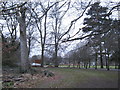
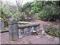
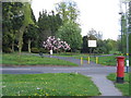
Residents of B13 8QQ enjoy a range of amenities within walking distance, including retail outlets such as Co-op Dads, Asda Kings, and Lidl Moseley. The area’s transport links provide access to parks like Moseley Park and Cannon Hill Park, donated in 1873 and described as hidden gems. These green spaces offer leisure opportunities, while the historic character of Moseley, including Spring Hill College and the Moseley Tunnel, adds cultural value. The proximity to rail and metro stations ensures easy access to Birmingham’s urban core, and the mix of retail and green spaces supports a balanced lifestyle. The compact nature of the area means amenities are closely clustered, reducing the need for long commutes. However, the high population density may mean local facilities are shared among a large number of residents.
Amenities
Schools
Residents of B13 8QQ have access to a range of primary schools, including Moor Green Infant School, Moor Green Junior School, and Moor Green Primary Academy, which holds an outstanding Ofsted rating. Uffculme School, a special needs institution, also serves the area. The presence of multiple primary schools, including one with a top rating, makes the area attractive for families. The mix of general and special needs education ensures a comprehensive educational offering, though no secondary schools are listed. The density of schools reflects the area’s focus on family living, with proximity to education being a key factor for homebuyers. Parents can choose between traditional primary schools and specialist provision, though the lack of secondary options may require commuting.
| Rank | School | Type | Entry gender | Ages |
|---|
Explore more schools in this area
Go to Schools tabDemographics
The community in B13 8QQ is predominantly middle-aged, with a median age of 47 and the most common age range being adults aged 30–64. Home ownership rates stand at 59%, indicating a mix of owner-occupied properties and rental homes. The area is characterised by houses rather than flats, reflecting a traditional suburban housing stock. The predominant ethnic group is White, though no specific data on diversity or deprivation is provided. The age profile suggests a stable, established population, likely with families and long-term residents. With a population density of 1,402 people per km², the area is compact, which may influence local amenities and social dynamics. The lack of specific data on deprivation means broader contextual assumptions about quality of life cannot be made, but the demographic stability implies a cohesive community.
Household Size
Accommodation Type
Tenure
Ethnic Group
Religion
Household Composition
Age
Household Deprivation
NS-SEC
Explore more demographic insights in this area
Go to Demographics tabPlanning
Planning Constraints
- Flood RiskPremium
- Ramsar Wetland SitesPremium
- Area of Outstanding Natural BeautyPremium
- Protected Nature ReservePremium
- Protected WoodlandPremium