Area Overview for B13 8QE
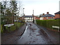
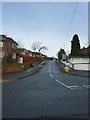
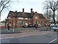
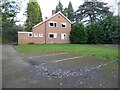
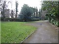
Photos of B13 8QE

Area Information
Living in B13 8QE means inhabiting a compact, residential cluster in the south of Birmingham, England. This area covers 24.3 hectares and is home to 1,785 people, with a population density of 1,402 people per square kilometre. Historically, Moseley—of which this postcode is part—was a rural village that transformed into a middle-class suburb during the 19th century. Its development was shaped by the Birmingham and Gloucester Railway, which opened in 1840, and the construction of Cannon Hill Park in 1873 from land donated by Louisa Ann Ryland. Today, the area blends suburban tranquillity with proximity to Birmingham’s urban core. Residents benefit from a mix of historical landmarks, such as Moseley Park and Pool, and modern amenities. The postcode’s small size means it is tightly integrated with surrounding areas like Kings Heath and Bournville, offering a balance of local character and regional connectivity. With a median age of 47 and a population skewed towards adults aged 30–64, the community reflects a settled, family-oriented demographic.
- Area Type
- Postcode
- Area Size
- 24.3 hectares
- Population
- 1785
- Population Density
- 1402 people/km²
The property market in B13 8QE is characterised by a 59% home ownership rate, with houses being the predominant accommodation type. This suggests a market skewed towards owner-occupation rather than rental properties, reflecting the area’s suburban nature. The compact size of the postcode means the housing stock is limited, with homes likely concentrated in established neighborhoods rather than new developments. For buyers, this implies a focus on existing properties rather than speculative investment. The presence of schools and amenities nearby may enhance property values, though the small area size means competition for available homes could be fierce. Prospective buyers should consider the proximity to Birmingham’s transport networks and the historical character of the area, which may appeal to those seeking a blend of tradition and convenience.
House Prices in B13 8QE
No properties found in this postcode.
Energy Efficiency in B13 8QE
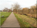
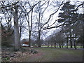
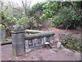
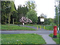
Residents of B13 8QE enjoy a range of amenities within easy reach. Retail options include Co-op Dads, Lidl Moseley, and Asda Kings, catering to everyday shopping needs. Parks such as Moseley Park and Pool and Cannon Hill Park offer green spaces for recreation, while historical sites like Spring Hill College add cultural value. The area’s transport links to Birmingham’s core and surrounding suburbs enhance its appeal, allowing easy access to urban amenities without sacrificing local character. The presence of multiple schools, combined with parks and retail, supports a balanced lifestyle, blending suburban comfort with urban connectivity. The compact size of the postcode means amenities are tightly clustered, reducing the need for long commutes.
Amenities
Schools
Residents of B13 8QE have access to several primary schools, including Moor Green Infant School, Moor Green Junior School, and Moor Green Primary Academy, which holds an outstanding Ofsted rating. Uffculme School, a special needs institution, also serves the area. The mix of primary schools and a special school provides families with options tailored to different educational needs. Moor Green Primary Academy’s high rating suggests a strong local education offering, which could be a key draw for families. The concentration of schools in the area reflects the community’s focus on education and the presence of a settled, family-oriented population. With multiple schools within practical reach, parents have choices for their children’s schooling, though the limited number of secondary schools may require commuting.
| Rank | School | Type | Entry gender | Ages |
|---|
Explore more schools in this area
Go to Schools tabDemographics
The community in B13 8QE is predominantly composed of adults aged 30–64, with a median age of 47. This suggests a mature, stable population, likely with established careers and family ties. Home ownership rates stand at 59%, indicating a significant portion of residents are long-term residents rather than renters. The area’s accommodation is primarily houses, reflecting a suburban character with larger, more private living spaces. The predominant ethnic group is White, though no further breakdown of diversity is provided. The high proportion of homeowners and the age profile suggest a community focused on long-term residency rather than transient populations. With no data on deprivation levels, it is unclear how economic pressures might affect quality of life, but the demographic stability implies a consistent demand for local services and infrastructure.
Household Size
Accommodation Type
Tenure
Ethnic Group
Religion
Household Composition
Age
Household Deprivation
NS-SEC
Explore more demographic insights in this area
Go to Demographics tabPlanning
Planning Constraints
- Flood RiskPremium
- Ramsar Wetland SitesPremium
- Area of Outstanding Natural BeautyPremium
- Protected Nature ReservePremium
- Protected WoodlandPremium