Area Overview for B13 8LH
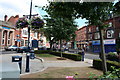
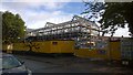
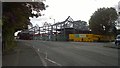
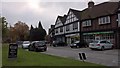
Photos of B13 8LH

Area Information
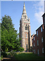
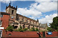
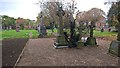
Living in B13 8LH, a small residential cluster in Birmingham’s Moseley area, offers a blend of suburban tranquillity and urban accessibility. With a population of 1,535, this postcode reflects a mature community, shaped by its history as a former independent village that merged with Birmingham in 1911. The area’s character is defined by its 19th-century transformation from rural land to a middle-class suburb, marked by high-density housing and historic landmarks like Moseley Hall and the Moseley Tunnel, believed to be Birmingham’s first railway tunnel. Residents benefit from proximity to Cannon Hill Park, donated in 1873, and Moseley Park and Pool, a local favourite. The area’s compact size means amenities are within walking distance, while rail links to Birmingham New Street and surrounding metro stations ensure easy access to the city. Daily life here balances quiet residential streets with the vibrancy of nearby retail hubs like Co-op Moseley and Lidl Sparkbrook.
- Area Type
- Postcode
- Area Size
- Not available
- Population
- 1535
- Population Density
- 3475 people/km²
The property market in B13 8LH is characterised by a 47% home ownership rate, indicating a balance between owner-occupied and rental properties. The area’s accommodation type is primarily houses, suggesting a focus on family homes rather than apartments or flats. This mix may appeal to buyers seeking stable, long-term housing in a low-rise, suburban setting. The small size of the postcode means the housing stock is limited, potentially making the local market competitive for buyers. Proximity to amenities like retail hubs, parks, and transport links enhances the area’s appeal, though the predominance of houses may limit options for those seeking alternative property types. Buyers should consider the local market’s sensitivity to demand and the potential for growth in a historically established suburb.
House Prices in B13 8LH
No properties found in this postcode.
Energy Efficiency in B13 8LH
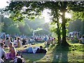
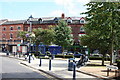
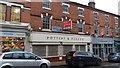
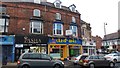
The lifestyle in B13 8LH is enriched by accessible amenities, including retail options like Co-op Moseley, M&S Moseley, and Lidl Sparkbrook, which cater to daily shopping needs. Parks such as Cannon Hill Park and Moseley Park and Pool provide green spaces for recreation, while historical sites like Spring Hill College add cultural depth. The area’s compact layout ensures residents can walk to shops, parks, and transport hubs, fostering a convenient, community-oriented lifestyle. The presence of special schools and a mix of retail and leisure facilities suggests a focus on family-friendly living. The character of Moseley, with its 19th-century infrastructure and public spaces, offers a blend of historical charm and modern practicality, making it appealing to those seeking a balanced, accessible environment.
Amenities
Schools
Residents of B13 8LH have access to a range of schools, including King David Primary School (primary, Ofsted rating: satisfactory) and Queensbridge School (primary, Ofsted rating: good). Special educational needs are supported by Fox Hollies School and Charles Burns School, both designated as special schools. The Regional Child and Adolescent Unit School serves a different educational focus. This mix of school types ensures families can find options for mainstream education, specialist support, or alternative learning environments. The presence of both primary and special schools suggests the area caters to diverse family needs, though the absence of secondary schools may require commuting for older students. Parents should evaluate the Ofsted ratings and specific provisions of each institution to align with their children’s requirements.
| Rank | School | Type | Entry gender | Ages |
|---|
Explore more schools in this area
Go to Schools tabDemographics
The community in B13 8LH has a median age of 47, with the majority of residents aged between 30 and 64. Home ownership stands at 47%, indicating a mix of owner-occupied properties and rental units. The area is predominantly composed of houses, reflecting a stable, family-oriented demographic. The predominant ethnic group is White, though specific data on diversity or deprivation is not provided. This age profile suggests a population with established careers and long-term residency, contributing to a sense of continuity. The 47% home ownership rate implies a moderate reliance on rental housing, which may influence local property dynamics. The absence of specific diversity metrics means the community’s composition remains largely unquantified beyond the stated figures.
Household Size
Accommodation Type
Tenure
Ethnic Group
Religion
Household Composition
Age
Household Deprivation
NS-SEC
Explore more demographic insights in this area
Go to Demographics tabPlanning
Planning Constraints
- Flood RiskPremium
- Ramsar Wetland SitesPremium
- Area of Outstanding Natural BeautyPremium
- Protected Nature ReservePremium
- Protected WoodlandPremium