Area Overview for B13 8JL
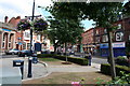
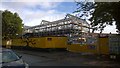
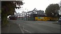
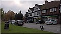
Photos of B13 8JL

Area Information
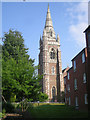
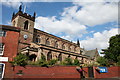
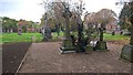
Living in B13 8JL, a small residential cluster in Birmingham’s Moseley area, offers a blend of suburban tranquillity and urban accessibility. With a population of 1,535, the area retains a village-like character despite its proximity to the city. Historically a rural chapelry established in 1853, Moseley evolved into a middle-class suburb during the 19th century, marked by high-density housing and piecemeal development. Today, it sits on the main road to Alcester, a turnpike since 1770, and benefits from the Birmingham and Gloucester Railway, which opened in 1840. Residents enjoy proximity to Cannon Hill Park, donated in 1873, and Moseley Park and Pool, a local gem. The area’s mix of historic architecture, such as Spring Hill College, and modern amenities creates a distinct identity. Daily life is shaped by nearby schools, rail links, and retail hubs, while the population’s median age of 47 suggests a community of established residents. B13 8JL is ideal for those seeking a balance between suburban comfort and city connectivity.
- Area Type
- Postcode
- Area Size
- Not available
- Population
- 1535
- Population Density
- 3475 people/km²
B13 8JL is characterised by a 47% home ownership rate, with houses forming the predominant accommodation type. This suggests a residential market skewed towards owner-occupied properties rather than rentals, though the exact proportion of rental homes is unspecified. The presence of houses indicates a focus on family-friendly, spacious living, contrasting with high-density housing seen in other parts of Birmingham. Given the area’s small size and limited data on property turnover, the market may be niche, appealing to buyers seeking established homes in a historically significant suburb. The mix of historic and modern housing stock, combined with proximity to transport links, could attract buyers prioritising location over new builds. However, the lack of detailed market trends means potential buyers should investigate local estate agent reports for current valuations and demand.
House Prices in B13 8JL
Showing 2 properties
| Address | Type | Beds | Baths | Last Sale Price | Last Sale Date | |
|---|---|---|---|---|---|---|
| Wards 3 To 8, Moseley Hall Hospital, 181 Alcester Road, Birmingham, B13 8JL | Detached | - | - | - | - | |
| The Lodge, Moseley Hall Hospital, Alcester Road, Birmingham, B13 8JL | Detached | - | - | - | - |
Energy Efficiency in B13 8JL
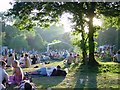
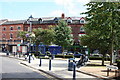
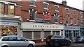
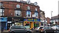
Residents of B13 8JL have access to a range of amenities within practical reach. Retail options include Co-op Moseley, M&S Moseley, and Lidl Sparkbrook, offering everyday shopping needs. The area’s transport links connect to rail and metro services, facilitating easy access to Birmingham’s city centre and beyond. Parks such as Cannon Hill Park and Moseley Park and Pool provide green spaces for leisure and exercise. The presence of Spring Hill College, a historic Gothic building, adds cultural value. While no specific dining venues are listed, the proximity to retail and transport hubs suggests a convenient lifestyle. The mix of parks, shops, and transport options supports a balanced daily life, blending suburban comfort with urban accessibility.
Amenities
Schools
B13 8JL is served by several schools, including King David Primary School and Queensbridge School, both rated as ‘satisfactory’ and ‘good’ by Ofsted, respectively. Fox Hollies School and Charles Burns School are special needs institutions, while The Regional Child and Adolescent Unit School caters to specific educational requirements. This mix of primary and special schools provides families with options tailored to different needs, from mainstream education to specialist support. The presence of multiple schools within proximity suggests a well-developed educational infrastructure, though no data on secondary schools is available. Parents seeking a range of school types may find the area appealing, though they should verify current Ofsted ratings and student outcomes for the most up-to-date picture.
| Rank | School | Type | Entry gender | Ages |
|---|
Explore more schools in this area
Go to Schools tabDemographics
The population of B13 8JL has a median age of 47, with the majority of residents aged 30–64. This suggests a community of middle-aged adults, likely including families and professionals. Home ownership stands at 47%, indicating a mix of owner-occupied and rental properties. The area is predominantly composed of houses, reflecting a traditional residential layout rather than flats or apartments. The predominant ethnic group is White, though specific data on diversity is not provided. The age profile implies a stable, mature population, which may influence local services and amenities. With no data on deprivation levels, it is unclear how economic factors affect quality of life, but the presence of schools and retail options suggests basic needs are met. The demographic profile aligns with Moseley’s historical development as a middle-class suburb, shaped by 19th-century expansion and industrial growth.
Household Size
Accommodation Type
Tenure
Ethnic Group
Religion
Household Composition
Age
Household Deprivation
NS-SEC
Explore more demographic insights in this area
Go to Demographics tabPlanning
Planning Constraints
- Flood RiskPremium
- Ramsar Wetland SitesPremium
- Area of Outstanding Natural BeautyPremium
- Protected Nature ReservePremium
- Protected WoodlandPremium