Area Overview for B13 8HL
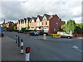
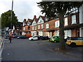
Photos of B13 8HL


Area Information
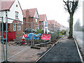
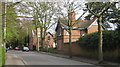
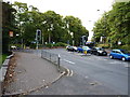
Living in B13 8HL means inhabiting a compact residential cluster in Birmingham’s West Midlands, where history and modernity intersect. With a population of 1,646, this area sits within the Brandwood & King’s Heath Ward, a suburban ward shaped by 18th-century road improvements and 19th-century housing expansions. The community is anchored by its proximity to the city centre, with easy access to rail and metro networks. Daily life here balances suburban tranquillity with urban connectivity, supported by nearby schools, retail, and transport hubs. The area’s character is defined by its historical roots as heathland, now transformed into a mix of older homes and family-oriented living. Residents benefit from a stable demographic profile, with adults aged 30–64 forming the majority. While the area lacks high-density development, its small scale fosters a sense of familiarity, though buyers should consider its limited property stock and the need for proximity to Birmingham’s broader amenities.
- Area Type
- Postcode
- Area Size
- Not available
- Population
- 1646
- Population Density
- 5942 people/km²
The property market in B13 8HL is characterised by a 52% home ownership rate, with houses forming the predominant accommodation type. This suggests a relatively low turnover of properties, typical of suburban areas where long-term residency is common. The limited number of homes in this small postcode area means the market is likely to be competitive for buyers, with limited scope for new developments. The focus on owner-occupied properties indicates a community of established residents rather than a rental-heavy market. For buyers, this means potential for stability but also the need to consider proximity to Birmingham’s broader housing stock for more options. The absence of high-density housing also means the area is unlikely to attract investors seeking short-term rental opportunities.
House Prices in B13 8HL
No properties found in this postcode.
Energy Efficiency in B13 8HL
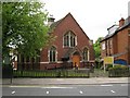
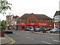
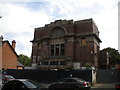
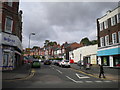
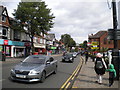
The lifestyle in B13 8HL is defined by its proximity to retail, transport, and historical sites. Nearby amenities include Asda Kings, Iceland Kings, and Lidl Moseley, offering everyday shopping needs. Rail and metro stations provide access to Birmingham’s wider networks, while the area’s historical character includes venues like the Hare and Hounds pub and Brandwood End Cemetery. The mix of retail and transport options ensures convenience for daily errands and commuting. However, the data does not mention parks or leisure facilities, so residents may need to travel to nearby areas for recreational spaces. The presence of historical landmarks adds cultural depth, but the area’s small size means it relies on surrounding suburbs for more extensive amenities.
Amenities
Schools
Residents of B13 8HL have access to three primary schools within the area: Kings Heath Junior School, Kings Heath Infant and Nursery School, and Kings Heath Primary School, which holds a ‘good’ Ofsted rating. These schools cater to younger children, providing a range of early education and primary-level learning opportunities. The presence of multiple primary schools within a short distance is a significant advantage for families, reducing the need for long commutes to education. However, the data does not mention secondary schools or higher education institutions, so families with older children may need to look further afield. The good rating at Kings Heath Primary School suggests a reliable standard of education, though parents should verify current performance metrics independently.
| Rank | School | Type | Entry gender | Ages |
|---|
Explore more schools in this area
Go to Schools tabDemographics
The demographic profile of B13 8HL reflects a mature, settled community. The median age is 47, with adults aged 30–64 comprising the most common age group. Home ownership stands at 52%, slightly below the national average, suggesting a mix of owner-occupied and rental properties. The area is predominantly composed of houses, indicating a lower density of apartments or flats. The predominant ethnic group is White, though the data does not specify further diversity metrics. This age profile suggests a community focused on stability, with fewer young families or elderly residents compared to other areas. The absence of detailed deprivation data means quality of life factors like access to services or employment opportunities are not quantified here, but the presence of schools and transport links implies reasonable infrastructure.
Household Size
Accommodation Type
Tenure
Ethnic Group
Religion
Household Composition
Age
Household Deprivation
NS-SEC
Explore more demographic insights in this area
Go to Demographics tabPlanning
Planning Constraints
- Flood RiskPremium
- Ramsar Wetland SitesPremium
- Area of Outstanding Natural BeautyPremium
- Protected Nature ReservePremium
- Protected WoodlandPremium