Area Overview for B13 8EZ
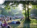
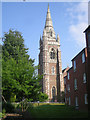
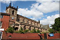
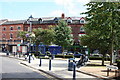
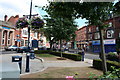
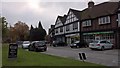
Photos of B13 8EZ

Area Information
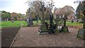
Living in B13 8EZ means being part of Moseley, a small residential cluster in Birmingham’s south, with a population of 1,535. This area, historically a village before its 1911 incorporation into Birmingham, retains a suburban character shaped by 19th-century development. Its streets are lined with houses, many dating to an era when Moseley transitioned from rural village to middle-class suburb. The area’s charm lies in its proximity to green spaces like Moseley Park and Cannon Hill Park, both established in the 1800s. Residents benefit from a mix of retail, rail, and metro connections, with nearby stations like Small Heath and Bordesley offering links to Birmingham New Street. Schools such as Queensbridge School (Ofsted rating: good) and specialist institutions like Fox Hollies School cater to diverse needs. While the population is small, the area’s history, amenities, and transport links make it a compact yet well-connected place for families and professionals seeking a balance of suburban tranquillity and urban accessibility.
- Area Type
- Postcode
- Area Size
- Not available
- Population
- 1535
- Population Density
- 3475 people/km²
The property market in B13 8EZ is defined by its 47% home ownership rate and a focus on houses rather than apartments or flats. This suggests a residential stock skewed toward single-family homes, typical of a suburban setting. Given the area’s small size and limited population, the housing supply is likely constrained, potentially driving demand for properties in nearby zones. The predominance of houses may appeal to families seeking space, though the lower home ownership rate could indicate a significant rental market. Buyers should consider that the area’s compact nature means property choices are limited, and proximity to amenities like schools and transport is a key factor. For those prioritising ownership, the existing housing stock offers a traditional suburban layout, but the lack of high-density development may limit options for those seeking modern or alternative living arrangements.
House Prices in B13 8EZ
No properties found in this postcode.
Energy Efficiency in B13 8EZ
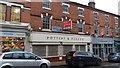
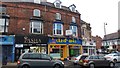
The lifestyle in B13 8EZ is shaped by its mix of retail, green spaces, and transport links. Nearby shops include M&S Moseley, Co-op Moseley, and Asda Kings, providing everyday convenience. Parks such as Moseley Park and Cannon Hill Park, established in the 1800s, offer recreational space with historical significance. The area’s character is enriched by landmarks like Spring Hill College, a 19th-century Gothic building, and the Moseley Tunnel, a relic of early railway engineering. Residents have access to cultural and educational sites, including specialist schools and historic buildings. The proximity to rail and metro stations ensures easy access to Birmingham’s urban centres, while the area’s compact nature fosters a sense of community. Whether shopping, relaxing in parks, or exploring historical sites, the lifestyle in B13 8EZ balances suburban comfort with urban connectivity, making it appealing for those valuing both convenience and heritage.
Amenities
Schools
Residents of B13 8EZ have access to a range of school types, including primary and specialist institutions. King David Primary School and Queensbridge School are both primary schools, with the latter holding a good Ofsted rating. Fox Hollies School and Charles Burns School are special needs institutions, catering to students with specific educational requirements. The Regional Child and Adolescent Unit School serves a different educational purpose, likely focused on therapeutic or specialist care. This mix of school types ensures families have options, whether for mainstream education or tailored support. The presence of both general and specialist schools reflects the area’s commitment to diverse educational needs. However, the absence of secondary schools within the postcode means parents may need to consider nearby areas for comprehensive schooling. The Ofsted ratings highlight variability in quality, with Queensbridge School standing out as a strong option for primary education.
| Rank | School | Type | Entry gender | Ages |
|---|
Explore more schools in this area
Go to Schools tabDemographics
The community in B13 8EZ has a median age of 47, with the majority of residents aged 30–64. This suggests a stable population of working-age adults and families, reflecting the area’s suburban character. Home ownership stands at 47%, indicating a mix of owner-occupied properties and rental units. The predominant accommodation type is houses, aligning with the area’s historical development as a low-density residential zone. The predominant ethnic group is White, though no further breakdown of diversity is provided. The relatively low home ownership rate may suggest a rental market presence, though the data does not specify. For quality of life, the age profile implies a community with established residents and fewer young families, potentially influencing local amenities and services. The absence of detailed deprivation data means this area’s socioeconomic challenges remain unquantified in the provided information.
Household Size
Accommodation Type
Tenure
Ethnic Group
Religion
Household Composition
Age
Household Deprivation
NS-SEC
Explore more demographic insights in this area
Go to Demographics tabPlanning
Planning Constraints
- Flood RiskPremium
- Ramsar Wetland SitesPremium
- Area of Outstanding Natural BeautyPremium
- Protected Nature ReservePremium
- Protected WoodlandPremium