Area Overview for B13 8EJ
Photos of B13 8EJ
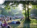
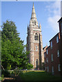
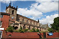
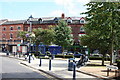
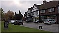
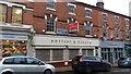
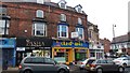
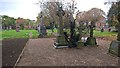
100 photos from this area
Area Information
Key information about the B13 8EJ including its size, population, and administrative classification.
- Area Type
- Postcode
- Area Size
- 5923 m²
- Population
- 1188
- Population Density
- 5665 people/km²
House Prices in B13 8EJ
46
Properties
£220,227
Average Sold Price
£50,000
Lowest Price
£415,000
Highest Price
Showing 46 properties
| Address | Type | Beds | Baths | Last Sale Price | Last Sale Date | |
|---|---|---|---|---|---|---|
| 30A Woodbridge Road, Birmingham, B13 8EJ | Semi-detached | 1 | 1 | £200,000 | Sep 2024 | |
| 26 Woodbridge Road, Birmingham, B13 8EJ | Terraced | 3 | 3 | £297,000 | Nov 2017 | |
| 42 Woodbridge Road, Birmingham, B13 8EJ | Terraced | 3 | 1 | £290,000 | Aug 2017 | |
| 30 Woodbridge Road, Birmingham, B13 8EJ | Terraced | 3 | 3 | £275,000 | May 2017 | |
| 32 Woodbridge Road, Birmingham, B13 8EJ | Semi-detached | 3 | 3 | £255,000 | May 2015 | |
| 28 Woodbridge Road, Birmingham, B13 8EJ | Terraced | 3 | - | £250,000 | Dec 2013 | |
| 44A Woodbridge Road, Birmingham, B13 8EJ | Flat | - | - | £150,000 | Jan 2009 | |
| 4A Woodbridge Road, Birmingham, B13 8EJ | Flat | - | - | £415,000 | Oct 2008 | |
| 46 Woodbridge Road, Birmingham, B13 8EJ | house | 3 | - | £103,000 | Jun 2000 | |
| 24 Woodbridge Road, Birmingham, B13 8EJ | Terraced | - | - | £137,500 | Apr 2000 |
Page 1 of 5
Energy Efficiency in B13 8EJ
Amenities
Schools
| Rank | School | Type | Entry gender | Ages |
|---|
Explore more schools in this area
Go to Schools tabDemographics
Household Size
One person
most common
Accommodation Type
Flats
most common
Tenure
41
majority
Ethnic Group
White
most common
Religion
N/A
most common
Household Composition
N/A
most common
Age
47
median
Adults (30-64 years)
most common
Household Deprivation
N/A
with no deprivation
NS-SEC
40
in Lower managerial occupations
Explore more demographic insights in this area
Go to Demographics tabPlanning
Planning Constraints
- Flood RiskPremium
- Ramsar Wetland SitesPremium
- Area of Outstanding Natural BeautyPremium
- Protected Nature ReservePremium
- Protected WoodlandPremium