Area Overview for B13 8DT
Photos of B13 8DT
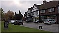
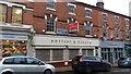
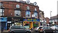
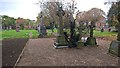
100 photos from this area
Area Information
Key information about the B13 8DT including its size, population, and administrative classification.
- Area Type
- Postcode
- Area Size
- 1.3 hectares
- Population
- 1607
- Population Density
- 7824 people/km²
House Prices in B13 8DT
63
Properties
£426,681
Average Sold Price
£230,001
Lowest Price
£936,000
Highest Price
Showing 63 properties
| Address | Type | Beds | Baths | Last Sale Price | Last Sale Date | |
|---|---|---|---|---|---|---|
| 40 Park Hill, Birmingham, B13 8DT | Semi-detached | 6 | 4 | £936,000 | Dec 2024 | |
| 54 Park Hill, Birmingham, B13 8DT | Retail | 11 | 3 | £820,000 | Feb 2023 | |
| 12 Park Hill, Birmingham, B13 8DT | house | 4 | - | £270,000 | Sep 2013 | |
| 62 Park Hill, Birmingham, B13 8DT | house | - | - | £377,500 | Jun 2007 | |
| 16 Park Hill, Birmingham, B13 8DT | Semi-detached | - | - | £250,000 | Jan 2006 | |
| 60 Park Hill, Birmingham, B13 8DT | house | 4 | - | £279,950 | Jun 2004 | |
| 18 Park Hill, Birmingham, B13 8DT | house | - | - | £250,000 | Feb 2004 | |
| 14 Park Hill, Birmingham, B13 8DT | Detached | - | - | £230,001 | Sep 2000 | |
| Flat 6, The Grange, 42 Park Hill, Birmingham, B13 8DT | Flat | 12 | - | - | - | |
| Flat 2, 54 Park Hill, Birmingham, B13 8DT | Flat | - | - | - | - |
Page 1 of 7
Energy Efficiency in B13 8DT
Amenities
Schools
| Rank | School | Type | Entry gender | Ages |
|---|
Explore more schools in this area
Go to Schools tabDemographics
Household Size
One person
most common
Accommodation Type
Flats
most common
Tenure
27
majority
Ethnic Group
asian_total
most common
Religion
N/A
most common
Household Composition
N/A
most common
Age
47
median
Adults (30-64 years)
most common
Household Deprivation
N/A
with no deprivation
NS-SEC
24
in Lower managerial occupations
Explore more demographic insights in this area
Go to Demographics tabPlanning
Planning Constraints
- Flood RiskPremium
- Ramsar Wetland SitesPremium
- Area of Outstanding Natural BeautyPremium
- Protected Nature ReservePremium
- Protected WoodlandPremium