Area Overview for B13 8AX
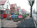
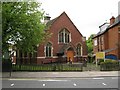
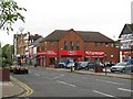
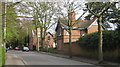
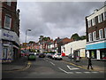
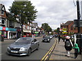
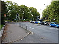
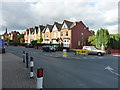
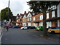
Photos of B13 8AX


Area Information
Living in B13 8AX offers a quiet, suburban lifestyle within the larger Brandwood & King’s Heath Ward of Birmingham. With a population of 1,479, this small postcode area reflects a blend of historical development and modern convenience. Situated south of Birmingham’s city centre, it lies within a ward that once encompassed heathland transformed by 18th-century road improvements and 19th-century housing expansions. The area retains traces of its past, such as the Hare and Hounds pub, built in the 1820s, and Brandwood End Cemetery, which preserves old field boundaries. Despite its proximity to the city, B13 8AX maintains a distinct character, with a focus on residential living and limited commercial density. Residents benefit from proximity to Birmingham’s transport networks, including multiple railway stations and metro stops, while the area avoids the congestion and deprivation seen in older parts of the city. Its small size and low population density create a sense of community, though it remains a niche postcode within the broader urban fabric.
- Area Type
- Postcode
- Area Size
- Not available
- Population
- 1479
- Population Density
- 5400 people/km²
The property market in B13 8AX is defined by a 61% home ownership rate and a predominance of houses, reflecting a suburban, owner-occupied market. This suggests that the area is not heavily reliant on rental properties, which may limit availability for tenants but could indicate stable property values. The focus on houses rather than flats or apartments aligns with the area’s low-density, residential character. Given the small size of the postcode and its integration into a larger ward, property buyers may find limited options within B13 8AX itself but could explore nearby areas with similar housing stock. The absence of high-rise developments or commercial properties reinforces the area’s appeal to those seeking traditional, family-oriented homes. However, the lack of detailed data on property prices or recent market trends means potential buyers should conduct local inspections to gauge current conditions.
House Prices in B13 8AX
No properties found in this postcode.
Energy Efficiency in B13 8AX
The lifestyle in B13 8AX is shaped by its proximity to retail, dining, and transport hubs. Nearby shops include Asda Kings, M&S Moseley, and Iceland Kings, offering everyday essentials and grocery options. The area’s rail and metro connections—Hall Green, Bournville, Yardley Wood, and others—provide access to Birmingham’s broader retail and leisure networks, from shopping centres to cultural venues. While the data does not specify parks or recreational spaces, the historical context of heathland suggests potential for green spaces, though this remains unconfirmed. The presence of multiple transport links and retail options enhances daily convenience, allowing residents to balance local amenities with city-wide opportunities. The character of B13 8AX is defined by its practicality, with a focus on accessibility rather than sprawling leisure facilities.
Amenities
Schools
The only named school near B13 8AX is Reach School, categorised as an "other" type in the data. No Ofsted rating or specific educational focus is provided, so details about its performance or facilities remain unclear. Families relying on this school would need to assess its suitability independently, as the data does not include rankings or curriculum information. The absence of additional schools in the dataset means it is uncertain whether the area offers a range of educational options, such as primary, secondary, or specialist institutions. For prospective buyers, this lack of data highlights the need to verify school quality through local reviews or direct inquiries, as the proximity of Reach School alone does not confirm a comprehensive educational ecosystem.
| Rank | School | Type | Entry gender | Ages |
|---|
Explore more schools in this area
Go to Schools tabDemographics
The demographic profile of B13 8AX reflects a mature, stable community. The median age is 47, with the most common age range being adults aged 30–64, indicating a population largely in their prime working and family-raising years. Home ownership stands at 61%, suggesting a mix of long-term residents and property investors. The predominant accommodation type is houses, which aligns with the area’s suburban character and lower density. The predominant ethnic group is White, though specific data on diversity or deprivation is not provided. This age profile and ownership rate imply a community focused on stability and long-term residency, with fewer transient populations. The absence of detailed diversity metrics means broader social dynamics remain unquantified, but the demographic suggests a relatively uniform population structure.
Household Size
Accommodation Type
Tenure
Ethnic Group
Religion
Household Composition
Age
Household Deprivation
NS-SEC
Explore more demographic insights in this area
Go to Demographics tabPlanning
Planning Constraints
- Flood RiskPremium
- Ramsar Wetland SitesPremium
- Area of Outstanding Natural BeautyPremium
- Protected Nature ReservePremium
- Protected WoodlandPremium