Area Overview for B13 8AD
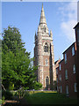
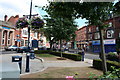
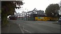
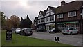
Photos of B13 8AD


Area Information
B13 8AD is a small residential postcode area in the heart of Moseley, a suburban ward in Birmingham, England. With a population of 1607, it reflects the character of a tight-knit community shaped by its 19th-century evolution from a rural village into a middle-class suburb. The area’s history is woven into its landscape, from the Moseley Tunnel—the first railway tunnel in Birmingham—to Cannon Hill Park, donated in 1873. Living here means proximity to both historical landmarks and modern amenities. The postcode covers a compact cluster of homes, predominantly flats, with a mix of retail and transport options nearby. Residents benefit from excellent broadband connectivity and access to three railway stations within reach, including Bordesley and Small Heath. For families, St John and Monica Catholic Primary School, rated ‘good’ by Ofsted, provides a solid foundation for education. While the area’s population is small, its strategic location near Birmingham’s core offers a balance of suburban tranquillity and urban convenience.
- Area Type
- Postcode
- Area Size
- Not available
- Population
- 1607
- Population Density
- 7824 people/km²
The property market in B13 8AD is characterised by a high concentration of flats, with only 27% of homes owned by residents. This suggests that the area functions more as a rental market than an owner-occupied one, likely attracting tenants rather than buyers seeking long-term investment. The small size of the postcode area means that housing stock is limited, and buyers may need to consider nearby suburbs for more options. The prevalence of flats indicates a focus on high-density living, which could appeal to those prioritising convenience and proximity to amenities. However, the low home ownership rate may also reflect affordability challenges or a preference for rental flexibility. For prospective buyers, the area’s compact nature means competition for properties could be fierce, and the market may be more responsive to demand from renters than first-time buyers.
House Prices in B13 8AD
No properties found in this postcode.
Energy Efficiency in B13 8AD
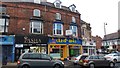
The lifestyle in B13 8AD is enriched by a mix of retail, transport, and green spaces. Nearby shops include Lidl Sparkbrook, Co-op Moseley, and M&S Moseley, providing access to groceries, clothing, and daily essentials. The area’s transport network is robust, with five railway stations and five metro stops within practical reach, connecting residents to Birmingham’s core and beyond. For leisure, Cannon Hill Park—created from donated land in 1873—offers open space for recreation, while Moseley Park and Pool is a local highlight. The presence of Spring Hill College and historical landmarks adds cultural depth. The compact nature of the postcode means amenities are closely clustered, reducing the need for long commutes. However, the limited range of services means residents may need to venture slightly further for specialist shopping or dining options. Overall, the area balances suburban comfort with urban accessibility.
Amenities
Schools
The nearest school to B13 8AD is St John and Monica Catholic Primary School, a primary institution with an Ofsted rating of ‘good’. This school serves the local community and is likely a key consideration for families moving to the area. The absence of secondary schools within the postcode means residents may need to look to nearby suburbs or Birmingham’s central areas for secondary education. The presence of a ‘good’-rated primary school indicates a commitment to quality education, though the limited range of schools suggests that families may need to plan for commuting to broader educational hubs. For those prioritising proximity to schools, B13 8AD offers a solid foundation at the primary level but requires additional research for secondary options.
| Rank | School | Type | Entry gender | Ages |
|---|
Explore more schools in this area
Go to Schools tabDemographics
The population of B13 8AD has a median age of 47, with the majority of residents aged 30–64. This suggests a community of working-age adults, many of whom may be employed in nearby Birmingham or commuting to other parts of the West Midlands. Home ownership in the area is relatively low at 27%, indicating that a significant proportion of residents rent their homes. The accommodation type is predominantly flats, reflecting a housing stock that caters to both long-term residents and those seeking rental properties. The predominant ethnic group is the Asian community, which contributes to the area’s cultural diversity. While no specific deprivation data is provided, the low home ownership rate and reliance on rental housing may influence the local economy and social dynamics. The age profile suggests a stable, mature population, with fewer young families compared to other parts of Birmingham.
Household Size
Accommodation Type
Tenure
Ethnic Group
Religion
Household Composition
Age
Household Deprivation
NS-SEC
Explore more demographic insights in this area
Go to Demographics tabPlanning
Planning Constraints
- Flood RiskPremium
- Ramsar Wetland SitesPremium
- Area of Outstanding Natural BeautyPremium
- Protected Nature ReservePremium
- Protected WoodlandPremium