Area Overview for B13 0UD
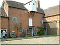
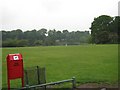
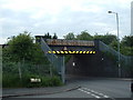
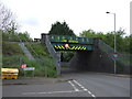
Photos of B13 0UD
Area Information
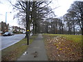
Living in B13 0UD presents a distinct experience within the wider Billesley ward of Selly Oak council in Birmingham. This specific postcode cluster sits four miles south-east of the city centre, placing you within a residential community that historically expanded from the former Billesley Estates in 1921. The area encompasses neighbourhoods stretching from Billesley Common near Chinn Brook Meadows into adjacent zones of Moseley, Hall Green, and Kings Heath. While the immediate cluster defined by this postcode contains approximately 1,771 residents, it serves as a gateway to a broader suburban lifestyle that includes parts of Wheelers Lane and Alchester Road South. You will find yourself in a location bordered by Swanshurst Park and The Dingles, offering a blend of suburban quiet and access to urban infrastructure. The area's history dates back over a millennium, with Billesley Manor recorded in the Domesday Book, yet the modern residential fabric is largely the result of early council estate development. For those researching homes in this postcode, the setting offers a grounded, residential character without significant planning constraints like protected woodlands or wetlands.
- Area Type
- Postcode
- Area Size
- Not available
- Population
- 1771
- Population Density
- 3164 people/km²
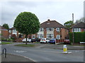
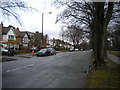
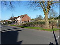
Homes in B13 0UD are defined by a clear distinction between owner-occupiers and renters, driven by a 41 per cent homeownership rate. This statistic signals that while there is a solid base of families who have settled in the area, a significant majority of the housing stock consists of tenanted properties. The predominant accommodation type listed is Houses, meaning you are unlikely to find the density of high-rise council blocks or large-scale flats common in some city fringe postcodes. Instead, expect a streetscape of detached or semi-detached homes typical of the 1920s estate development mentioned in local history. For buyers looking at this specific cluster and its immediate surroundings, the market likely offers a mix of older family homes available for purchase and rental units that cycle through occupiers constantly. The low level of rental stockholding at around 60 per cent implies strong local demand for tenancies but also suggests that purchase opportunities may be concentrated among existing landlords releasing properties or the general open market.
House Prices in B13 0UD
No properties found in this postcode.
Energy Efficiency in B13 0UD
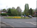
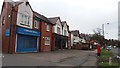
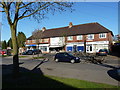
Residents of B13 0UD enjoy ready access to essential amenities within practical reach of their doorstep. Retail needs are met by five notable shops including Co-op Sparkhill, Heron Yardley, and Tesco Robin, ensuring you can grab groceries and essentials without traveling far. Your commute or day trip options are supported by five nearby railway stations, specifically Yardley Wood, Hall Green, and Spring Road, providing direct rail links into the city. For those preferring metro services, Grand Central New Street, Corporation Street, and Edgbaston Village are within reach, offering alternative transport routes. Leisure and open space are highlighted by local features like Billesley Common, Chinn Brook Meadows, and Swanshurst Park. These green spaces, often managed by groups such as Friends of Billesley Commons, offer residents a natural environment for walking and recreation. This combination of retail, rail, and parkland creates a self-contained lifestyle where most daily activities can be managed locally, saving time and reducing reliance on private vehicles.
Amenities
Schools
Education near B13 0UD is well served by a variety of institutions catering to all age groups. You have access to Billesley Junior School, a primary facility located within walking distance of the cluster. Families further down the road will look to Billesley Infant School and Billesley Primary School for younger and older children respectively. Notably, Billesley Primary School holds an outstanding Ofsted rating, a top distinction that validates its educational provision. For secondary education, Kings Heath Secondary School serves the catchment area with a good Ofsted rating, ensuring continuity from early years through to GCSEs. Having two primary options in the name Billesley, along with a highly rated secondary school, means parents in B13 0UD do not need to travel far for schooling. This concentration of educational facilities with strong ratings supports families seeking reliable education options without relying on transport to distant academy trusts or city-centre schools.
| Rank | School | Type | Entry gender | Ages |
|---|
Explore more schools in this area
Go to Schools tabDemographics
The community profile for B13 0UD reflects a mature population with a median age of 47 years. Most residents fall into the adult age range of 30 to 64 years, suggesting a neighbourhood stripped of the transient feel of student housing or young, single-person holds. Family structure and stability seem prevalent, supported by a homeownership rate standing at 41 per cent. This figure indicates a balanced market where one in two households still rents, creating a diverse tenant mix alongside permanent residents. You will find the local population predominantly White, contributing to a traditional suburban demographic often found in established Birmingham wards. With Houses constituting the primary accommodation type, the physical environment is likely built for family living rather than high-density flats. The age distribution and tenure split suggest an environment where long-term residents coexist with a steady stream of professional renters. This demographic stability provides a predictable community dynamic for new buyers looking to settle down in B13 0UD without the volatility of a rapidly changing young family zone.
Household Size
Accommodation Type
Tenure
Ethnic Group
Religion
Household Composition
Age
Household Deprivation
NS-SEC
Explore more demographic insights in this area
Go to Demographics tabPlanning
Planning Constraints
- Flood RiskPremium
- Ramsar Wetland SitesPremium
- Area of Outstanding Natural BeautyPremium
- Protected Nature ReservePremium
- Protected WoodlandPremium