Area Overview for B13 0TE
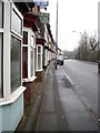
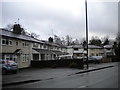
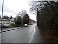
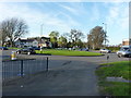
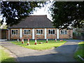
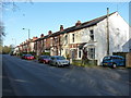
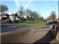
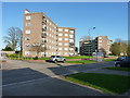
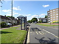
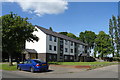
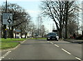
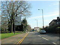
Photos of B13 0TE
Area Information
Living in B13 0TE means being part of a small, tightly knit residential cluster in the heart of Birmingham’s Billesley area. With a population of just 1,606, this postcode covers a compact stretch of homes nestled 4 miles south-east of the city centre. The area’s history dates back to the 1920s, when council estates were built on former farmland, shaping a community that blends suburban calm with proximity to urban amenities. Residents here benefit from easy access to nearby parks like Swanshurst Park and Billesley Common, as well as historic sites such as Billesley Manor, which traces its roots to 705 AD. The area’s charm lies in its balance: a quiet, family-friendly environment with practical connectivity to Birmingham’s transport networks and retail hubs. For those seeking a manageable, low-rise residential area with a sense of local identity, B13 0TE offers a distinct alternative to the city’s more densely populated zones.
- Area Type
- Postcode
- Area Size
- Not available
- Population
- 1606
- Population Density
- 4268 people/km²
The property market in B13 0TE is characterised by a 50% home ownership rate, suggesting a mix of owner-occupied homes and rental properties. The predominant accommodation type is houses, which aligns with the area’s suburban feel and appeal to families. This housing stock indicates a focus on single-family dwellings rather than apartments or high-rise developments, which is typical of smaller, residential postcode areas. Given the small size of the area, the housing stock is limited, meaning buyers should consider nearby zones for broader options. The 50% ownership rate also implies a rental market that may offer opportunities for investors or those seeking flexibility. However, the compact nature of B13 0TE means that property availability is constrained, and buyers may need to look beyond the immediate postcode for larger selections. The presence of houses suggests a market that caters to those prioritising space and private outdoor areas over urban convenience.
House Prices in B13 0TE
No properties found in this postcode.
Energy Efficiency in B13 0TE
The lifestyle in B13 0TE is enriched by a range of nearby amenities, from retail to transport hubs. Within walking distance are notable retail outlets such as Co-op Sparkhill, Iceland Kings, and Sainsburys Kings, offering everyday shopping needs. The area’s proximity to rail stations like Yardley Wood and Hall Green, along with metro stops like Grand Central New Street, ensures easy access to Birmingham’s transport networks. For leisure, residents can enjoy nearby parks such as Billesley Common and Swanshurst Park, which provide green spaces for relaxation and outdoor activities. The presence of these amenities fosters a convenient, self-contained lifestyle, blending suburban tranquillity with urban accessibility. Whether shopping, commuting, or enjoying nature, the area’s layout supports a practical and varied daily life.
Amenities
Schools
Residents of B13 0TE have access to Swanshurst School, which operates both as a primary school and an academy. These institutions serve the local community, offering a range of educational options for families. The presence of both a primary school and an academy indicates a structured approach to education, with the primary school catering to younger children and the academy providing secondary-level education. While no Ofsted ratings are provided in the data, the availability of two schools within the area suggests a focus on localised, community-based education. For families prioritising proximity to schools, B13 0TE’s educational offerings are a key consideration. The dual presence of primary and academy schooling may also reflect a deliberate effort to meet the needs of different age groups within the area’s population.
| Rank | School | Type | Entry gender | Ages |
|---|
Explore more schools in this area
Go to Schools tabDemographics
The community in B13 0TE is predominantly middle-aged, with a median age of 47 and the most common age range being adults aged 30–64. This suggests a stable, established population, likely with long-term ties to the area. Home ownership rates stand at 50%, indicating a mixed market where half of residents own their homes and the other half rent. The accommodation type is primarily houses, reflecting a residential character that leans towards family homes rather than high-density housing. The predominant ethnic group is White, though no further breakdown of diversity is provided in the data. The age profile and ownership figures imply a community that is neither heavily skewed towards young professionals nor retirees, but rather a balance of working-age individuals and families. This demographic structure supports a local economy that prioritises services and amenities catering to daily life rather than transient populations.
Household Size
Accommodation Type
Tenure
Ethnic Group
Religion
Household Composition
Age
Household Deprivation
NS-SEC
Explore more demographic insights in this area
Go to Demographics tabPlanning
Planning Constraints
- Flood RiskPremium
- Ramsar Wetland SitesPremium
- Area of Outstanding Natural BeautyPremium
- Protected Nature ReservePremium
- Protected WoodlandPremium