Area Overview for B13 0EW
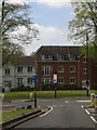
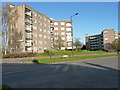
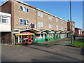
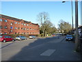
Photos of B13 0EW

Area Information
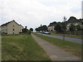
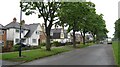
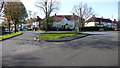
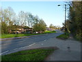
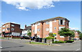
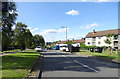
Living in B13 0EW means inhabiting a small, defined postcode area in Birmingham’s Selly Oak ward, a historically rich suburb with a mix of residential clusters and green spaces. The area spans parts of Billesley, Moseley, Hall Green, Yardley Wood, and Kings Heath, bordered by parks like Billesley Common and Chinn Brook Meadows. With a population of 1,771, it is a compact community where homes are predominantly houses, reflecting a quieter, more residential character. The area’s roots trace back to 705 AD with Billesley Manor, and its modern development began in 1921 as a council estate. Today, it balances historical heritage with practical modern living, offering proximity to Birmingham’s city centre (4 miles south-east) while retaining a distinct local identity. Residents benefit from nearby amenities, including schools, rail links, and community spaces, making it a viable choice for those seeking a blend of accessibility and residential tranquillity. The area’s small size means it is tightly connected to surrounding neighbourhoods, creating a cohesive network of services and infrastructure.
- Area Type
- Postcode
- Area Size
- Not available
- Population
- 1771
- Population Density
- 3164 people/km²
The property market in B13 0EW is characterised by a 41% home ownership rate, suggesting that less than half of properties are owner-occupied. This indicates a significant rental market, which may affect property availability and competition for buyers. The area’s accommodation type is predominantly houses, reflecting a focus on single-family homes rather than apartments or flats. Given the postcode’s small size and the presence of nearby council estates from the 1920s, the housing stock is likely a mix of older and newer properties. Buyers should consider the limited scale of the area, which means the immediate surroundings may offer more options. The house-centric nature of the market may appeal to those seeking traditional family homes, but the lower home ownership rate could signal a reliance on rental properties for housing diversity.
House Prices in B13 0EW
No properties found in this postcode.
Energy Efficiency in B13 0EW
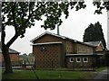
The lifestyle in B13 0EW is shaped by nearby amenities, including retail outlets like Co-op Sparkhill, Heron Yardley, and Tesco Kings. These shops provide essential services and convenience for daily needs. The area’s proximity to parks such as Billesley Common, Chinn Brook Meadows, and Swanshurst Park offers green spaces for recreation and relaxation. Community initiatives like the Friends of Billesley Commons highlight local engagement with public spaces. The mix of retail, transport hubs, and parks creates a balanced environment where residents can access both urban and natural amenities. This blend of practicality and greenery supports a lifestyle that prioritises accessibility without sacrificing outdoor space, making it appealing to families and individuals seeking a connected yet peaceful setting.
Amenities
Schools
B13 0EW is served by a range of schools, including Billesley Infant School and Billesley Junior School, both primary institutions. Billesley Primary School holds an Ofsted rating of outstanding, while Kings Heath Secondary School is rated good. This combination of primary and secondary schools provides families with options across educational stages. The presence of two primary schools in the area suggests a focus on early education, with one achieving exceptional standards. For secondary education, Kings Heath Secondary School offers a reliable option with a solid rating. The school mix supports families needing both primary and secondary placements, though the absence of additional schools may require commuting for higher education. The Ofsted ratings indicate that at least one school meets high standards, which is a positive factor for prospective residents.
| Rank | School | Type | Entry gender | Ages |
|---|
Explore more schools in this area
Go to Schools tabDemographics
B13 0EW has a median age of 47, with the majority of residents falling into the 30-64 age range. This suggests a community skewed towards adults, likely including families and professionals. Home ownership stands at 41%, indicating a mix of owner-occupied properties and rental stock. The predominant accommodation type is houses, which aligns with the area’s residential character. The dominant ethnic group is White, though specific data on diversity is not provided. The population figure of 1,771 is notably lower than official estimates, which may reflect the postcode’s limited scope or data discrepancies. For quality of life, the age profile implies a stable, mature demographic, potentially with established local networks. However, the relatively low home ownership rate suggests a portion of the population may be renting, which could influence the local rental market dynamics.
Household Size
Accommodation Type
Tenure
Ethnic Group
Religion
Household Composition
Age
Household Deprivation
NS-SEC
Explore more demographic insights in this area
Go to Demographics tabPlanning
Planning Constraints
- Flood RiskPremium
- Ramsar Wetland SitesPremium
- Area of Outstanding Natural BeautyPremium
- Protected Nature ReservePremium
- Protected WoodlandPremium