Area Overview for B13 0EP
Photos of B13 0EP
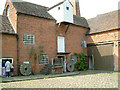
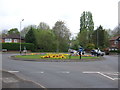
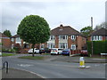
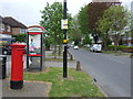
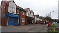
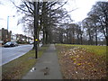
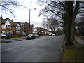
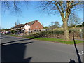
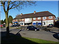
79 photos from this area
Area Information
Key information about the B13 0EP including its size, population, and administrative classification.
- Area Type
- Postcode
- Area Size
- 1.3 hectares
- Population
- 1505
- Population Density
- 5766 people/km²
House Prices in B13 0EP
26
Properties
£240,500
Average Sold Price
£110,000
Lowest Price
£520,000
Highest Price
Showing 26 properties
| Address | Type | Beds | Baths | Last Sale Price | Last Sale Date | |
|---|---|---|---|---|---|---|
| 12 Sandy Croft, Billesley, Birmingham, B13 0EP | Detached | 4 | 2 | £520,000 | Dec 2024 | |
| 24 Sandy Croft, Billesley, Birmingham, B13 0EP | house | - | - | £382,500 | Jun 2021 | |
| 10 Sandy Croft, Billesley, Birmingham, B13 0EP | Semi-detached | 3 | 1 | £290,000 | Dec 2019 | |
| 17 Sandy Croft, Billesley, Birmingham, B13 0EP | Semi-detached | 3 | 1 | £318,000 | Oct 2018 | |
| 8 Sandy Croft, Billesley, Birmingham, B13 0EP | Semi-detached | 1 | - | £230,000 | Jun 2014 | |
| 16 Sandy Croft, Billesley, Birmingham, B13 0EP | house | - | - | £195,000 | Jun 2013 | |
| 23 Sandy Croft, Billesley, Birmingham, B13 0EP | house | - | - | £250,000 | Aug 2010 | |
| 19 Sandy Croft, Billesley, Birmingham, B13 0EP | house | - | - | £235,000 | Oct 2009 | |
| 2 Sandy Croft, Billesley, Birmingham, B13 0EP | Semi-detached | 4 | 1 | £207,000 | Jul 2007 | |
| 6 Sandy Croft, Billesley, Birmingham, B13 0EP | Detached | - | - | £145,000 | Jan 2002 |
Page 1 of 3
Energy Efficiency in B13 0EP
Amenities
Schools
| Rank | School | Type | Entry gender | Ages |
|---|
Explore more schools in this area
Go to Schools tabDemographics
Household Size
Family (3-5 people)
most common
Accommodation Type
Houses
most common
Tenure
75
majority
Ethnic Group
asian_total
most common
Religion
N/A
most common
Household Composition
N/A
most common
Age
47
median
Adults (30-64 years)
most common
Household Deprivation
N/A
with no deprivation
NS-SEC
39
in Lower managerial occupations
Explore more demographic insights in this area
Go to Demographics tabPlanning
Planning Constraints
- Flood RiskPremium
- Ramsar Wetland SitesPremium
- Area of Outstanding Natural BeautyPremium
- Protected Nature ReservePremium
- Protected WoodlandPremium