Area Overview for B13 0AT
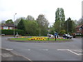
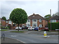
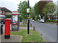
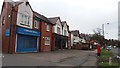
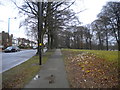
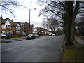
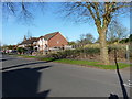
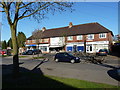
Photos of B13 0AT
Area Information
B13 0AT is a small residential cluster situated within the Billesley ward of the City of Birmingham district. This specific postcode serves a population of approximately 1,620 residents, creating a tight-knit community environment that differs from the wider suburban sprawl of neighbouring West Midlands locations. Located four miles south-east of Birmingham city centre, the area is part of the Selly Oak parliamentary constituency. The suburb has historical roots dating back to the establishment of the Billesley Estates in 1921, which developed on former farm land north of Trittiford Road and south of Billesley Farm. Living in B13 0AT means residing in a zone that borders Billesley Common, Chinn Brook Meadows, The Dingles, and Swanshurst Park. While the provided population figure suggests a smaller, more contained neighbourhood, the area's layout connects it to broader developments in Moseley, Hall Green, Yardley Wood, and Kings Heath. The postcode covers a specific cluster of streets that benefit from proximity to these established communities while maintaining its own distinct residential identity.
- Area Type
- Postcode
- Area Size
- Not available
- Population
- 1620
- Population Density
- 3522 people/km²
The housing market in B13 0AT is characterised by a strong preference for owner-occupation rather than the rental sector. With 72% of residents owning their homes, the area offers an environment where existing property owners have formed a stable community. This statistic points to a housing stock that has been held for significant periods, reducing transient turnover often found in high-rental zones. The accommodation type is almost exclusively Houses, meaning you are likely to find bungalows, detached homes, or semi-detached properties rather than large blocks of flats. This structure supports a suburban lifestyle away from the high-density living often associated with major city conurbations. Buyers looking at homes in B13 0AT encounter a market where purchase is the primary mode of entry. The dominance of houses aligns with the demographic reality of a median age of 47, suggesting families and professionals seeking space and permanence. This pattern creates a predictable market segment focused on maintenance and upgrade rather than frequent transactional change.
House Prices in B13 0AT
No properties found in this postcode.
Energy Efficiency in B13 0AT
Residents of B13 0AT have convenient access to retail and transport hubs despite the postcode's small size. You can shop at Co-op Sparkhill, Tesco Hall, and Tesco Robin, which provide essential groceries and daily necessities within practical reach. These outlets ensure that shopping trips do not require long journeys for household maintenance or family needs. For travel, five railway stations lie nearby, including Hall Green, Yardley Wood, and Spring Road stations. These links connect you to the wider network without needing to cross the city centre for most regional trips. Furthermore, five metro options are accessible, such as Grand Central New Street, Corporation Street, and Town Hall, offering extensive coverage across Birmingham and beyond. Living in B13 0AT blends the convenience of suburban living with the accessibility of a major transport network. The proximity to these named venues means you can reach diverse destinations quickly, balancing the quiet of a smaller residential cluster with the utility of an urban neighbourhood.
Amenities
Schools
| Rank | School | Type | Entry gender | Ages |
|---|
Explore more schools in this area
Go to Schools tabDemographics
The community in B13 0AT reflects a mature demographic profile with a median age of 47 years. Most residents fall into the 30 to 64 years range, indicating a population with significant working years or established family life before retirement. Home ownership stands at a high level of 72%, suggesting stability and long-term investment in the local housing stock. This sector is predominantly made up of Houses, typical of the expansion era communities that characterise much of the area's housing fabric. The residents are diverse, with the Asian total ethnic group being the most common demographic in this specific cluster. This composition paints a picture of a settled neighbourhood where families and individuals with purchasing power have stayed for the long term. The age profile aligns well with areas where school-age children have already moved on or settled into local institutions, while young professionals or retirees begin to take prominence in the later years of their lives.
Household Size
Accommodation Type
Tenure
Ethnic Group
Religion
Household Composition
Age
Household Deprivation
NS-SEC
Explore more demographic insights in this area
Go to Demographics tabPlanning
Planning Constraints
- Flood RiskPremium
- Ramsar Wetland SitesPremium
- Area of Outstanding Natural BeautyPremium
- Protected Nature ReservePremium
- Protected WoodlandPremium