Area Overview for B13 0AF
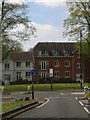
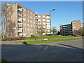
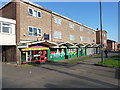
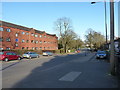
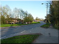
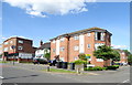
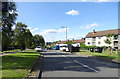
Photos of B13 0AF

Area Information
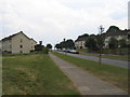
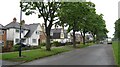
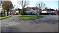
B13 0AF is a small residential postcode area in Birmingham, England, encompassing parts of Billesley, Moseley, Hall Green, and Kings Heath. With a population of 1,771, it is a compact community situated 4 miles south-east of the city centre. The area is defined by its historical roots, including Billesley Manor, which dates back to 705 AD and was recorded in the Domesday Book. Modern development began in 1921 with council estates built on former farmland, shaping today’s residential layout. Billesley Common and nearby green spaces like Chinn Brook Meadows and Swanshurst Park provide natural boundaries and recreational opportunities. The area blends suburban living with proximity to urban amenities, offering a mix of housing types and a community character shaped by its long-standing ties to Birmingham’s growth. Its location near rail and metro networks ensures connectivity to the city, while its modest size means a tight-knit, manageable environment for residents.
- Area Type
- Postcode
- Area Size
- Not available
- Population
- 1771
- Population Density
- 3164 people/km²
B13 0AF is primarily a residential area with a focus on houses rather than flats or apartments. The 41% home ownership rate indicates that nearly two-thirds of properties are likely rented, which could make the area appealing to buyers seeking long-term investment or families looking for stable housing. The prevalence of houses suggests a more traditional suburban layout, possibly with larger gardens or outdoor spaces, which may attract buyers prioritising family-friendly environments. However, the small size of the postcode area means the housing stock is limited, and buyers may need to consider nearby suburbs for more options. The mix of owner-occupied and rental properties could also mean competitive pricing or fluctuating availability. For those considering the area, the focus on houses may align with preferences for spacious, low-density living, though the limited scale of the area may require a broader search for larger properties.
House Prices in B13 0AF
No properties found in this postcode.
Energy Efficiency in B13 0AF
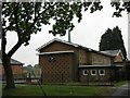
Residents of B13 0AF have access to a range of amenities within practical reach, including retail options like Co-op Sparkhill, Heron Yardley, and Tesco Kings. These shops provide everyday essentials, while nearby rail stations such as Yardley Wood, Hall Green, and Spring Road offer easy access to wider Birmingham. Metro stops like Grand Central New Street and Edgbaston Village further enhance connectivity, supporting both local and regional travel. The area’s proximity to Billesley Common and other green spaces ensures opportunities for outdoor activities, walking, or relaxation. The combination of retail, transport, and green spaces creates a balanced lifestyle, blending convenience with a touch of natural surroundings. For families, the mix of schools and accessible amenities makes daily life practical, while the suburban setting offers a quieter alternative to the city’s busier areas.
Amenities
Schools
B13 0AF is served by a range of primary and secondary schools, including Billesley Infant School, Billesley Junior School, Billesley Primary School (rated outstanding by Ofsted), and Kings Heath Secondary School (rated good). The presence of two primary schools with an outstanding rating suggests high-quality early education options, while the secondary school provides a solid foundation for older students. The diversity of school types ensures families have choices, whether prioritising a single primary school or a broader secondary education. The proximity of these institutions, many within walking distance, makes the area attractive for families. The outstanding rating at Billesley Primary School, in particular, highlights a local strength in education, which could be a key factor for homebuyers. The mix of school types also supports a seamless transition from primary to secondary education within the area.
| Rank | School | Type | Entry gender | Ages |
|---|
Explore more schools in this area
Go to Schools tabDemographics
The population of B13 0AF has a median age of 47, with the most common age range being adults aged 30–64. This suggests a mature, established community, likely with a mix of long-term residents and families. Home ownership stands at 41%, indicating a significant proportion of renters, which may reflect the area’s role as a mix of owner-occupied and rental properties. The predominant accommodation type is houses, which aligns with the suburban character of the area. The predominant ethnic group is White, though the data does not specify further diversity metrics. With a median age in the mid-40s, the community may have a stable demographic profile, potentially attracting professionals or families seeking a quieter, semi-urban lifestyle. The relatively low home ownership rate could also suggest a transient element, though the area’s established nature suggests a degree of permanence for many residents.
Household Size
Accommodation Type
Tenure
Ethnic Group
Religion
Household Composition
Age
Household Deprivation
NS-SEC
Explore more demographic insights in this area
Go to Demographics tabPlanning
Planning Constraints
- Flood RiskPremium
- Ramsar Wetland SitesPremium
- Area of Outstanding Natural BeautyPremium
- Protected Nature ReservePremium
- Protected WoodlandPremium